The Virginia Department of Environmental Quality lifted drought watch and warning advisories for 76 counties and cities in Virginia, including all Richmond-area localities.
With Tropical Storm Debby producing significant rain across much of the state, the major water supply reservoirs in Virginia returned to normal storage ranges.
Most areas in Virginia also showed improvements in streamflow conditions, but groundwater levels in several regions are in need of more rain to recover.


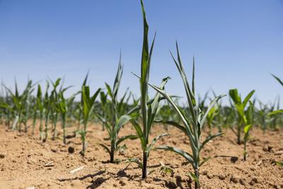
A row of field corn twists in the heat at the Chesterfield Berry Farm in Moseley on June 25. Owner Aaron Goode uses irrigation methods to keep the farm’s crops going during a drought.
According to this week's U.S. Drought Monitor map, the Shenandoah Valley and parts of Northern Virginia are experiencing severe drought conditions, but the update marks an improvement over the extreme drought conditions from last week's report.
People are also reading…
Richmond is continuing to trend toward the lower end of the scale, with the region split between having no drought conditions or abnormally dry conditions.
A drought warning advisory remains in place for the Shenandoah Valley per the DEQ, while a drought watch advisory is still in effect for the Big Sandy region, which covers the southwest corner of the state.
The DEQ coordinated with the Virginia Drought Monitoring Task Force to update the drought advisory declarations.
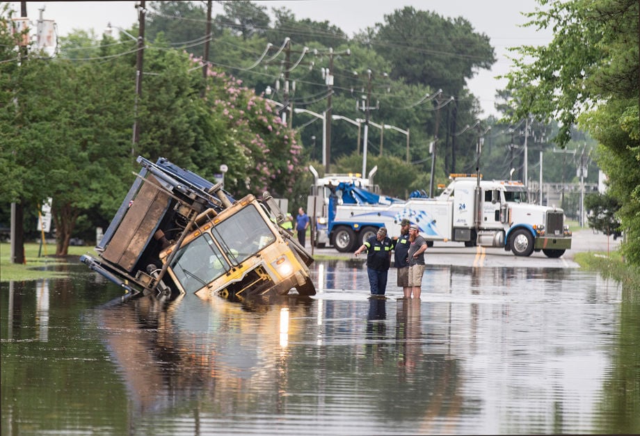
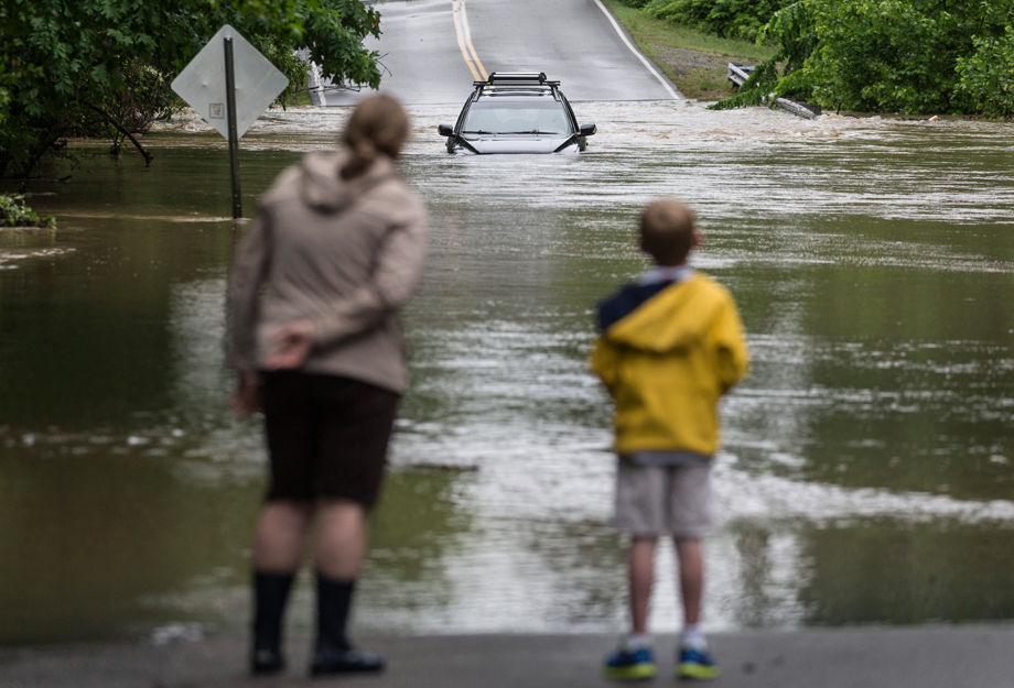
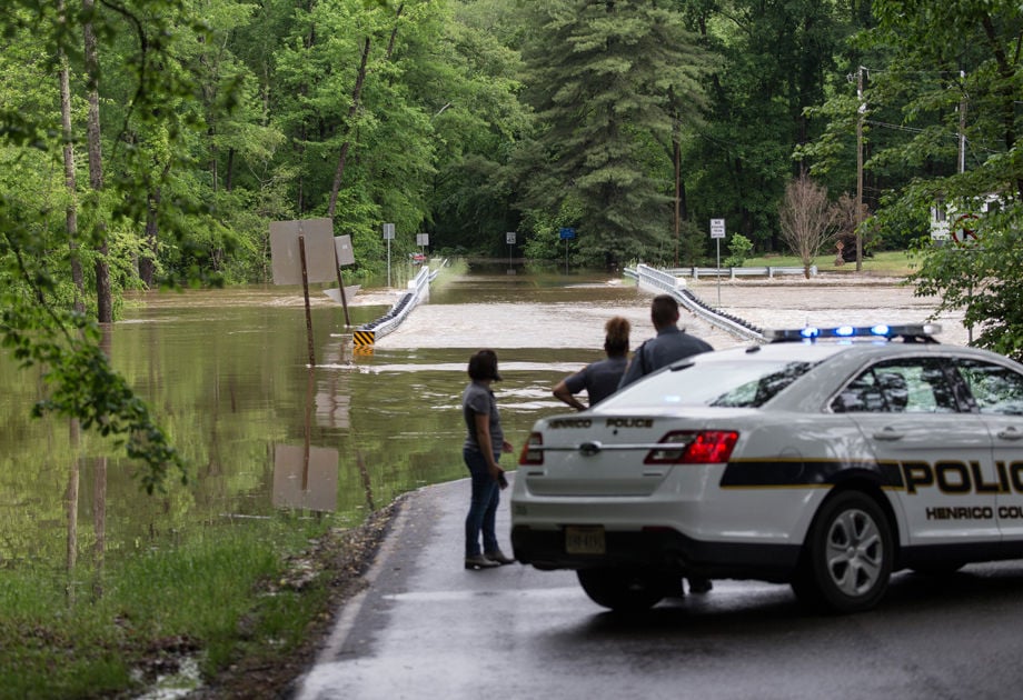
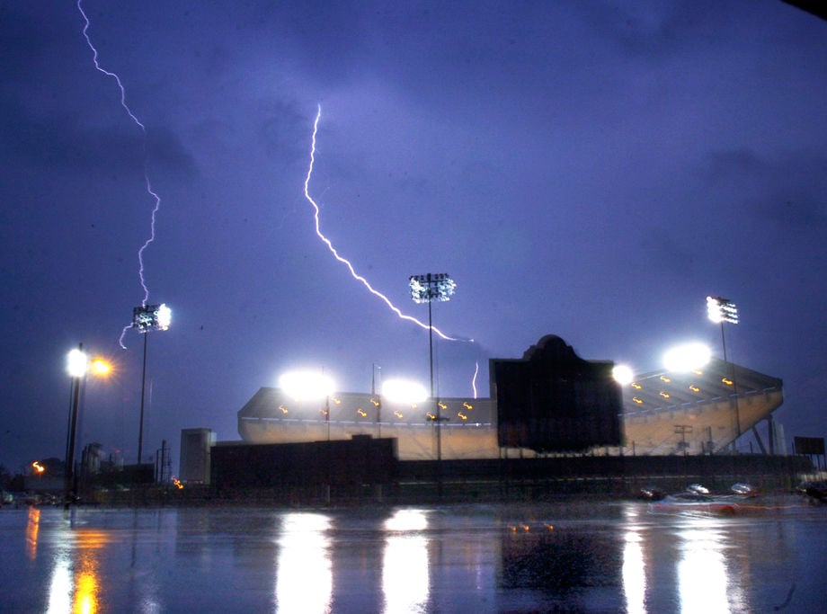
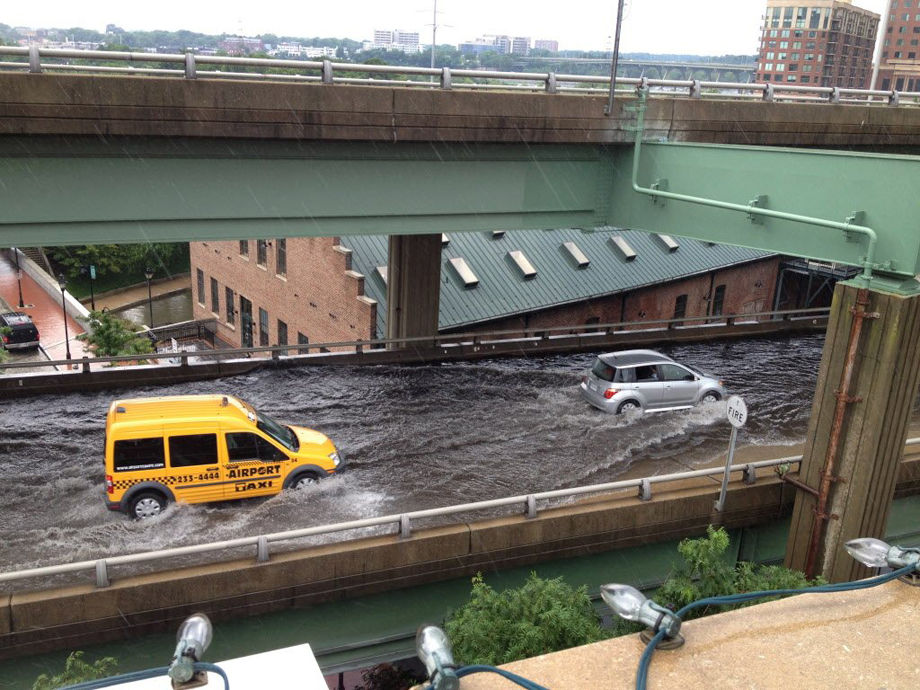
180 dramatic weather photos from the RTD archives

A street sign fell down when this tree landed on 4107 Patterson Avenue after Hurricane Irene came through Richmond last weekend. Photo taken Thursday, September 1, 2011.
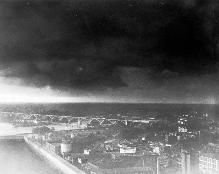
Severe storm lowers over Richmond. Date on photo is July 21, 1951, but the storm of 1951 happened June 13. There was a storm July 21, 1956, so I am presuming that instead of receiving this photo more than a month after the storm in 1951, the date stamp was incorrect and this was actually the 1956 storm. I could be mistaken.

Winds tore off an awning, twisted beams and smashed windows last night at Bennett Ford Inc.
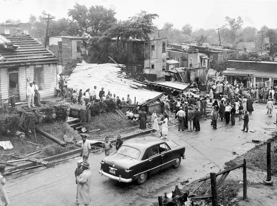
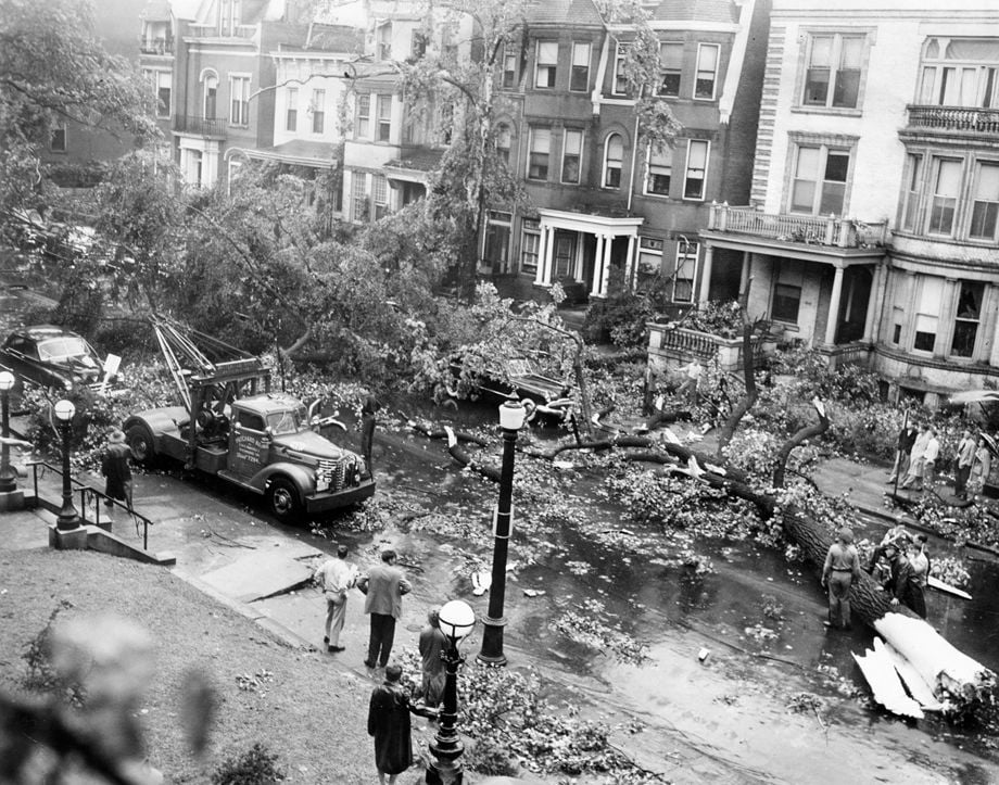
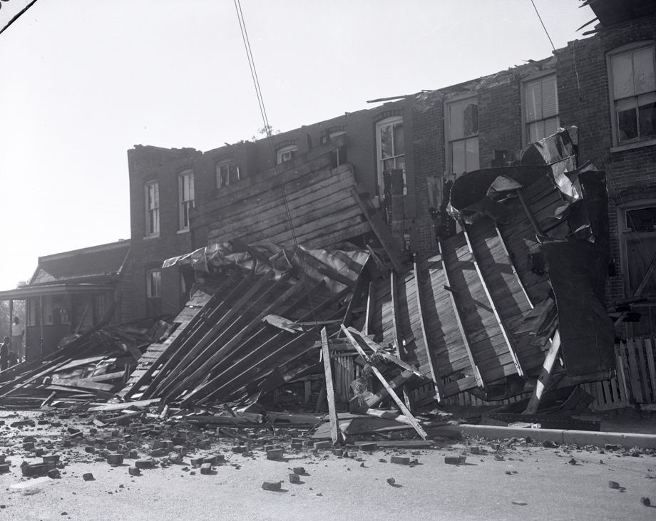
Building at Allen and Maplewood avenues was smashed flat by wind.
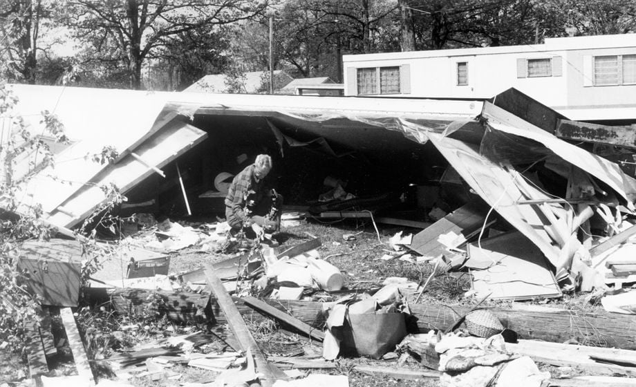
Relative searched through remains of Isabel Ott's mobile home on U.S. 460. in April 1978.
Tornado felled trees in front of Commonwealth Club on Franklin St., June 13, 1951.
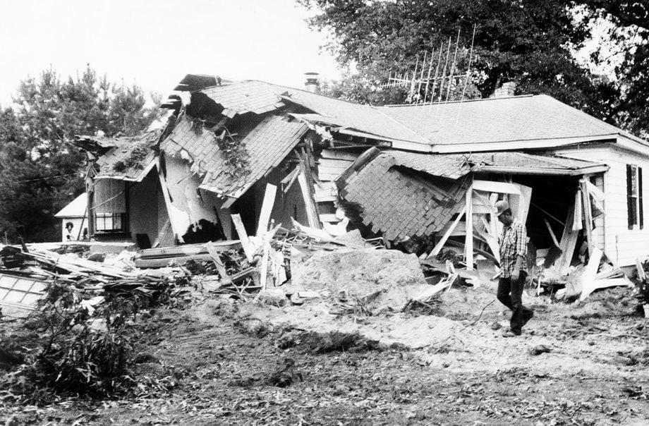
Oak tree that smashed Sussex County house was cut up and hauled away.
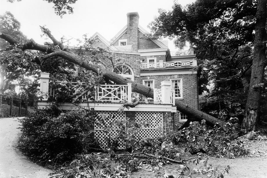
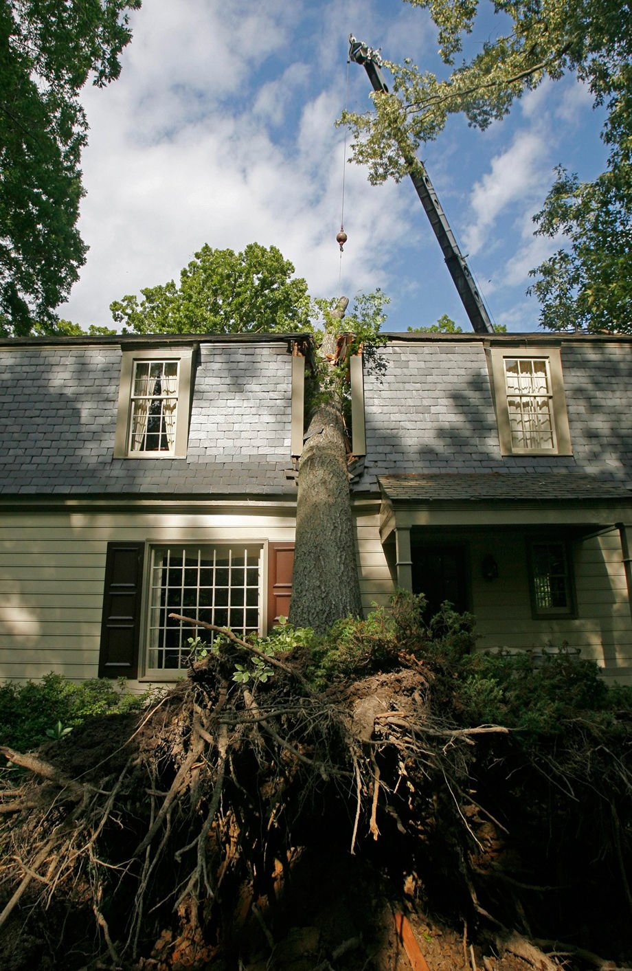
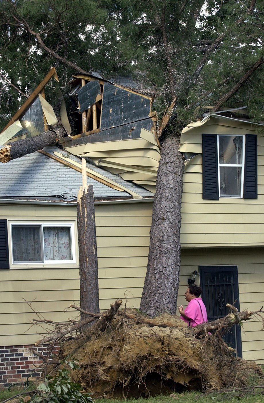
Like many houses in the West End of Richmond, the home of Harry and Susan Lankenau at 11 River Road was a casualty of Friday's storm that meteorologists are now calling a minitornado. The sun room took a direct hit from a falling tree.
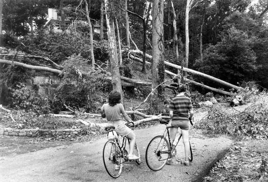
Bicyclists look at tree damage on W. Thomas Rich property on Riverside Drive. High wind, officially described as small tornado, swept across James River and cut across Rice property.
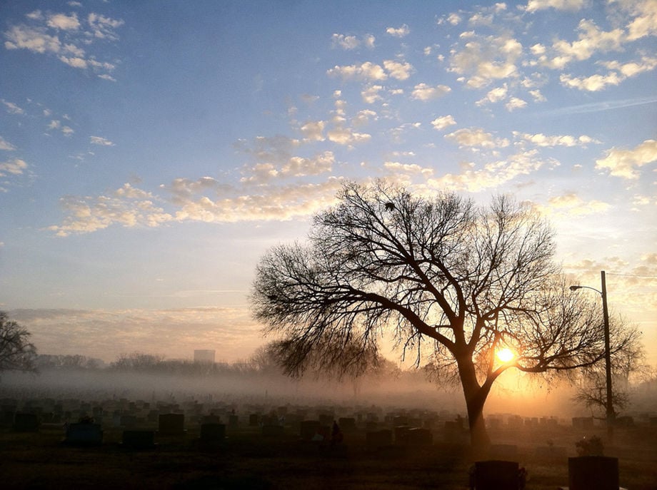
Photo made early this morning while passing Riverview Cemetery on Colorado Ave.in Richmond, VA. It was taken with the HDR mode on an iPhone.

Clouds light up after the sunset Thursday, August 25, 2005 in Richmond, VA against a skyline of trees and church steeples.
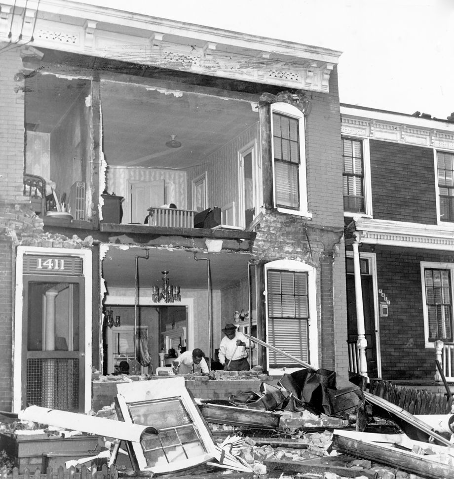
A June 13, 1951, tornado ripped through the heart of Richmond in the late afternoon, injuring dozens and destroying or damaging more than 150 buildings -- including Walter Cosby's home at 1411 W. Cary St. -- in its 4-mile path of destruction. Said one resident of Lakeview Avenue: "I thought the world was coming to an end." The home of Walter Cosby, 1411 West Cary St.
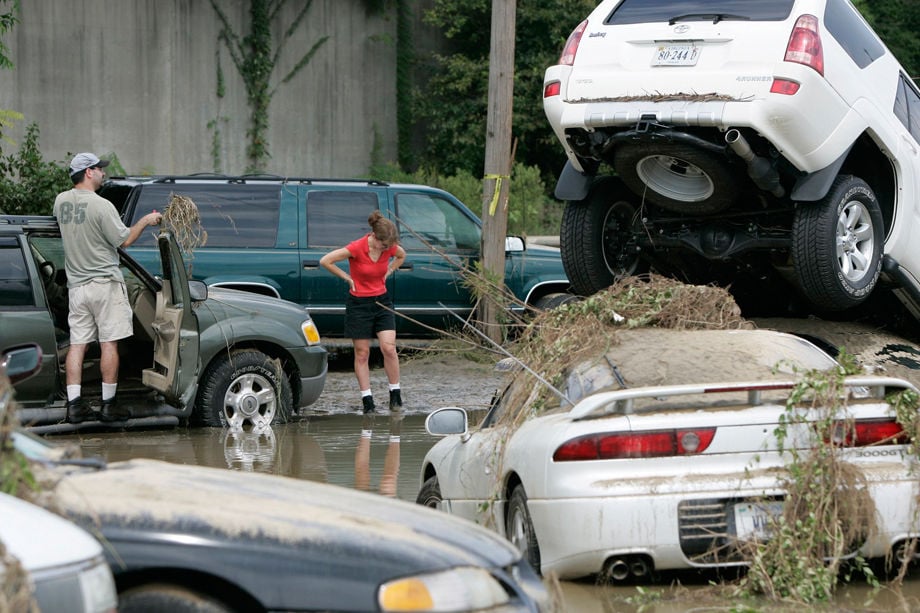
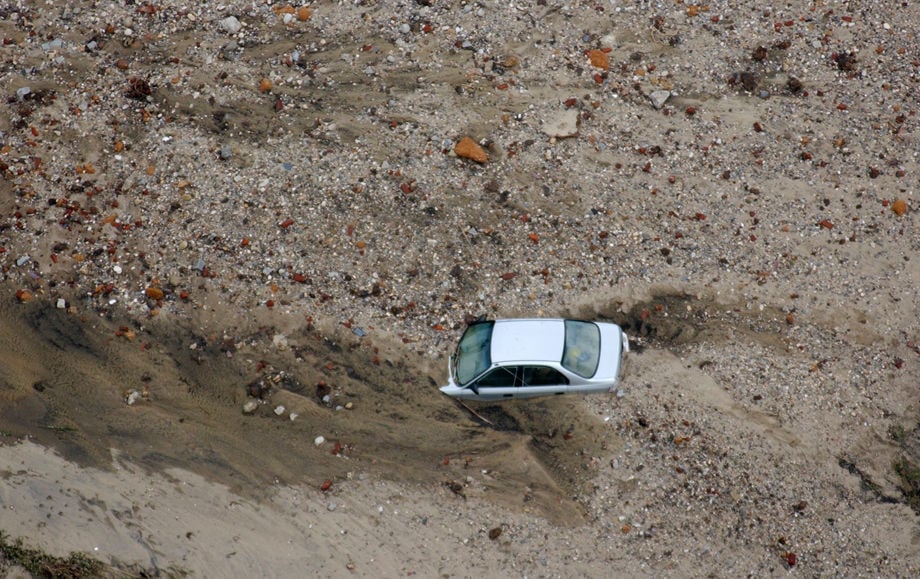
Joe and Tracey Gendron retrieve personal belongings from their automobile after it was washed away in Monday's flooding caused by Tropical Storm Gaston in the Shockoe Bottom area of Richmond on Aug. 31 2004. In the hard-hit Shockoe Bottom district, dozens of cars were tossed about in the streets, which were left caked with mud and strewn with bricks and other debris.
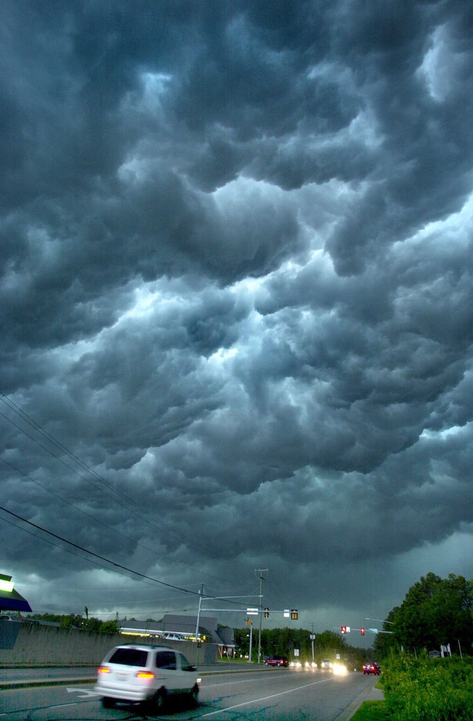
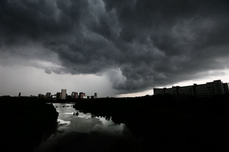
Storm clouds roll into Richmond's west end on 5/9/02, accompanying a line of heavy thunderstorms with reached from the northern neck of Virginia to the North Carolina line.
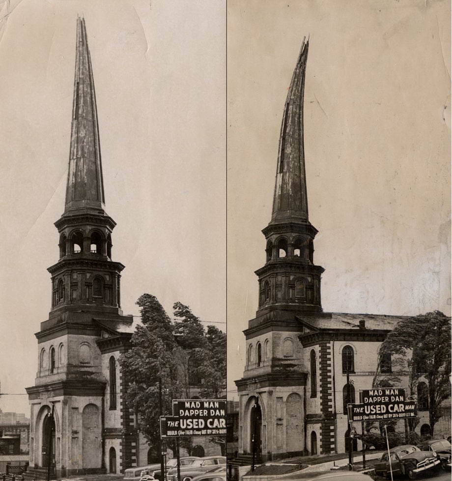
HURRICANE HAZEL: OCTOBER 16 1954 (Cutline) Buffeting like this toppled a section of Old Trinity Methodist Church Steeple. Steeple and trees sway South (left) then North (right) as Wind shifts during hurricane (Hazel) The Old Trinity Methodist Church known as "the mother of Methodism" in Richmond was sold in 1945 to New Light Baptist Church, which occupied the building at the time of Hurricane Hazel

Caitilyn Thomas 7, of Richmond, Va. is surrounded by flying snow after becoming airborne while sledding along 2nd Street in downtown Richmond on Wednesday, Jan. 22, 2014. Central Virginia experienced the first significant snowfall of the season with 2-4 inches of snow locally and single-digit temperatures in the early morning hours.
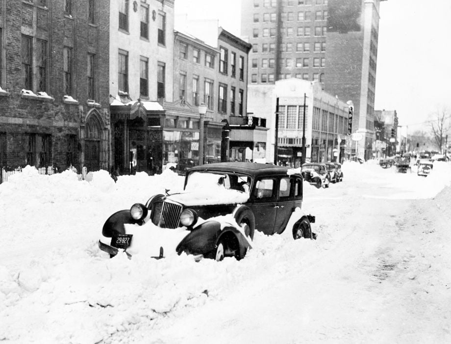
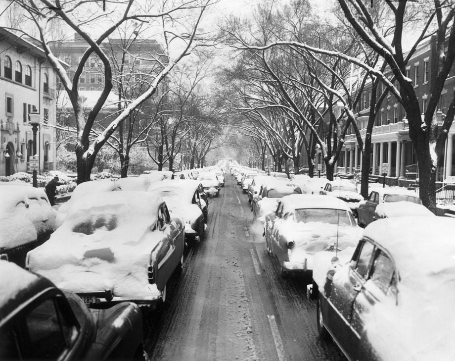
This is the way Grace Street, near Fourth, looked after the big snow 25 years ago. The snowfall in Richmond on January 23, 1940 and the following day was measured officially at 21.6 inches.
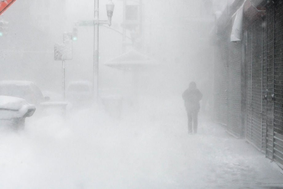
Snow blows around a pedestrian on Broad St. in Richmond after another crippling snowstorm hit the area.
A large tree rests on a house on Bellevue Ave on the Northside of Richmond.
High winds blew a tree into a house along West Salisbury Road across from Salisbury Country Club in Chesterfield County at about 1:30 p.m. on Friday, May 19, 2006. Dangerous winds that rolled across the Richmond area during the afternoon also led to reports of property damage in Richmond and other parts of Chesterfield and Henrico counties. No injuries were reported.
A large oak tree fell last night on 9010 Splitwood Circle in the West End, crushing a car and damaging the house owned by Daniel Hamilton and family. They were on vacation but Hamilton returned today with his brother-in-law.
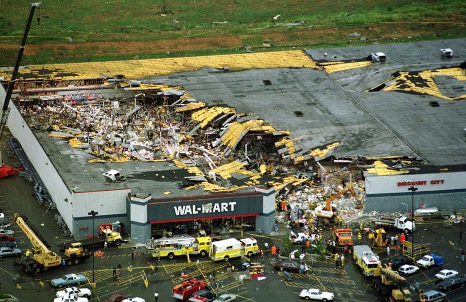
A tornado went across the Appomattox River and cut a path through a Colonial Heights Walmart, killing two cashiers and fatally injuring a customer on August 6, 1993.
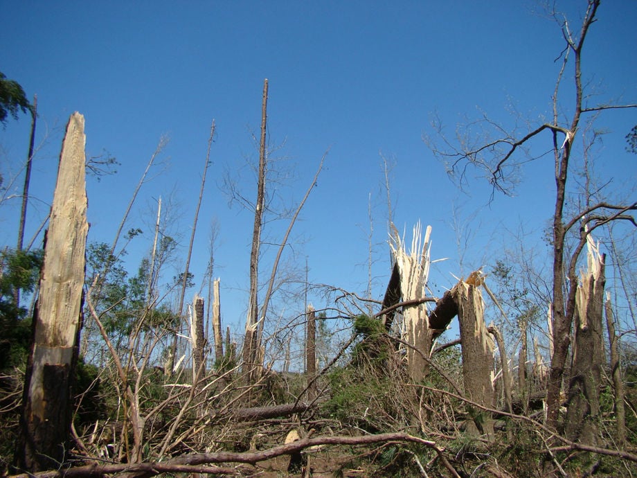
Tornado damage in a forest area of 50-year-old trees or older in Dinwiddie County.
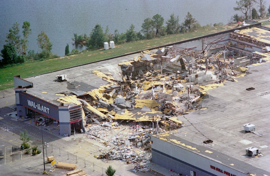
Wal-Mart on August 31, 1993, after Petersburg Colonial Heights Tornado, Aug. 6, 1993 8/6/2018: A strong tornado that hit the Tri-Cities on Aug. 6, 1993, killed three people at the Colonial Heights Walmart. A fourth person died about a mile away. TIMES-DISPATCH
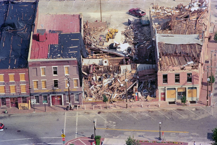
Old Towne damage Aug. 31, after Petersburg Tornado, Aug. 6, 1993 8/6/2018: A strong tornado that hit the Tri-Cities on Aug. 6, 1993, killed three people at the Colonial Heights Walmart. A fourth person died about a mile away.

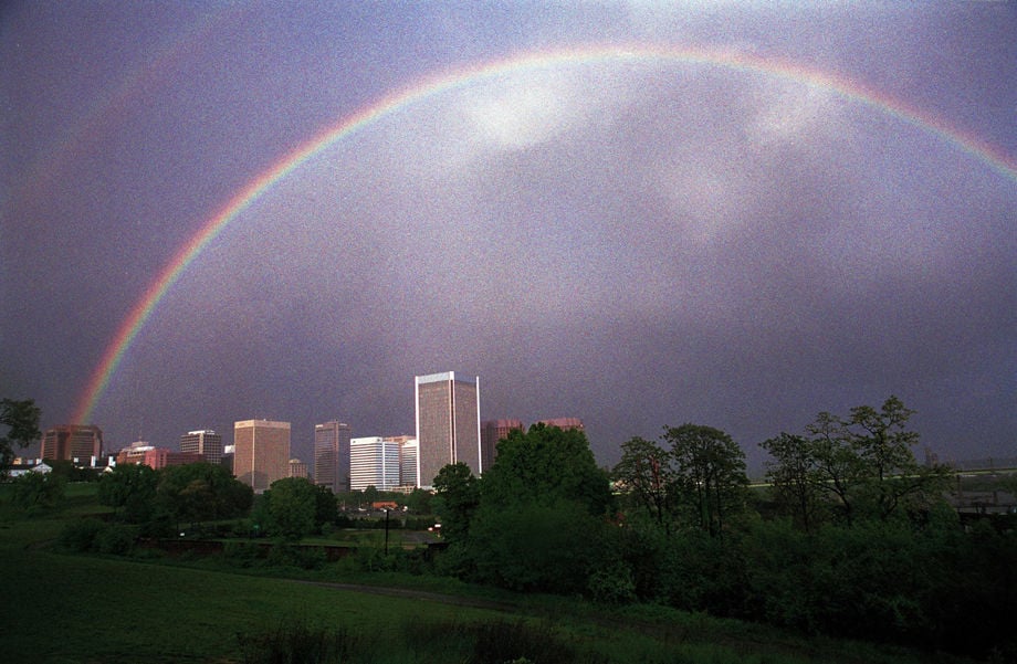
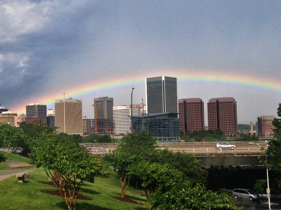
The double rainbow was over the Richmond area on April 21, 2009. Over I-295
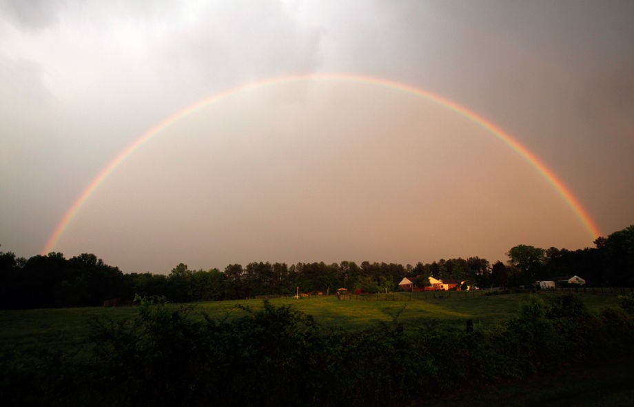
A rainbow was spotted in the Varina district of eastern Henrico County, VA Thursday, April 28, 2011, after a strong storm front passed through the area.
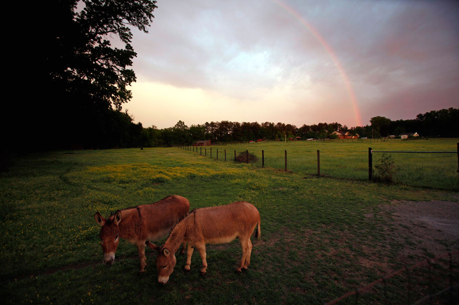
Sammy, left, and Robin, two Sicilian burros, appear to be ignoring a rainbow in the Varina district of eastern Henrico County, VA Thursday, April 28, 2011, after a strong storm front passed through the area.
Rainbows appeared over downtown Richmond after a rain storm. Photo taken around 7:15 P.M. from near the north end of the Lee Bridge. April 27, 2000. RAINBOW
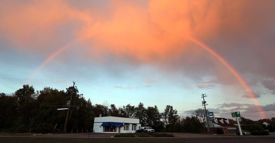
A full rainbow appeared at sunset over the Varina Cleaners on New Market Rd. in the Varina district of eastern Henrico County, VA Wednesday, Oct. 23, 2013.
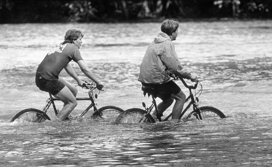
05-08-1989 (cutline): Aqua cycling--Mark Oliver (left), 20, and his 16 year-old brother, Justin, drove down to Riverside Drive from the Fan district yesterday to look for "aqua cycling" challenges. Here, they pedal through flood waters in the parking lot of Pony Pasture. Richmond police had closed off sections of about 10 streets yesterday because of flood waters.
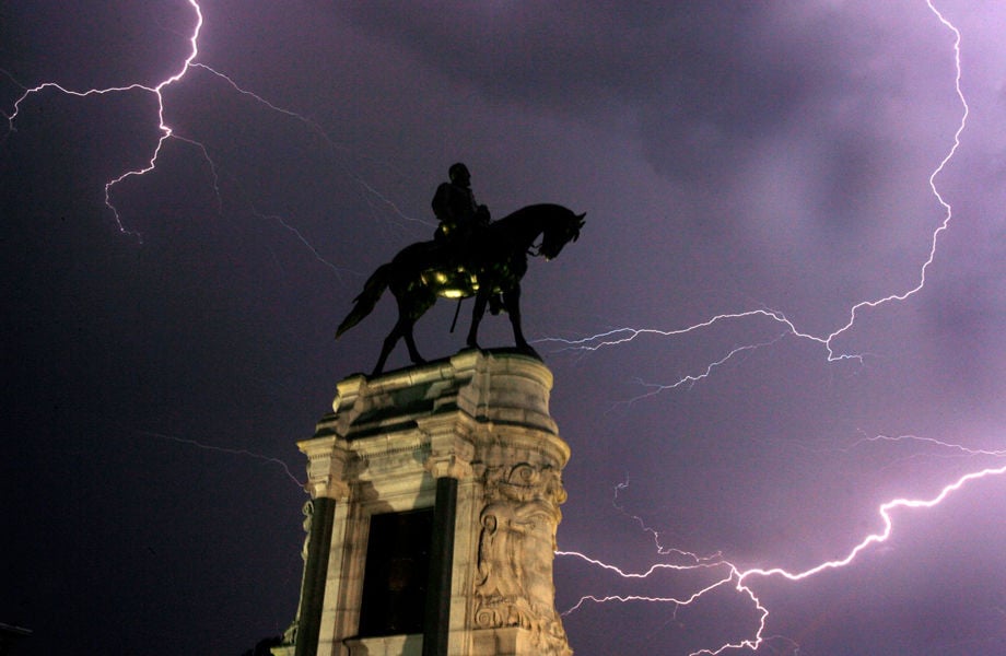
A storm that rolled through Richmond highlights the Robert E. Lee statue on Monument Avenue LIBRARY NOTE: LIGHTNING
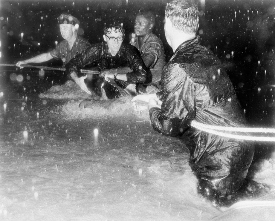
07-23-1969 (cutline): Policemen and firemen use rope to air a man who was stranded in the Williamsburg Avenue area. Seventy Richmond area families left homeless...fire, police and rescue squadsmen fighting six-foot flas floods in rescue attempts...cars swept up and tossed around like small toys...Stranded motorists sitting on roofs of their cars awaiting help...Water rushing from first-floor windows of Fulton homes...No serious injuries reported--"amazing," fire officials say...Rain-soaked hill on Church Hill slide away during height of storm.
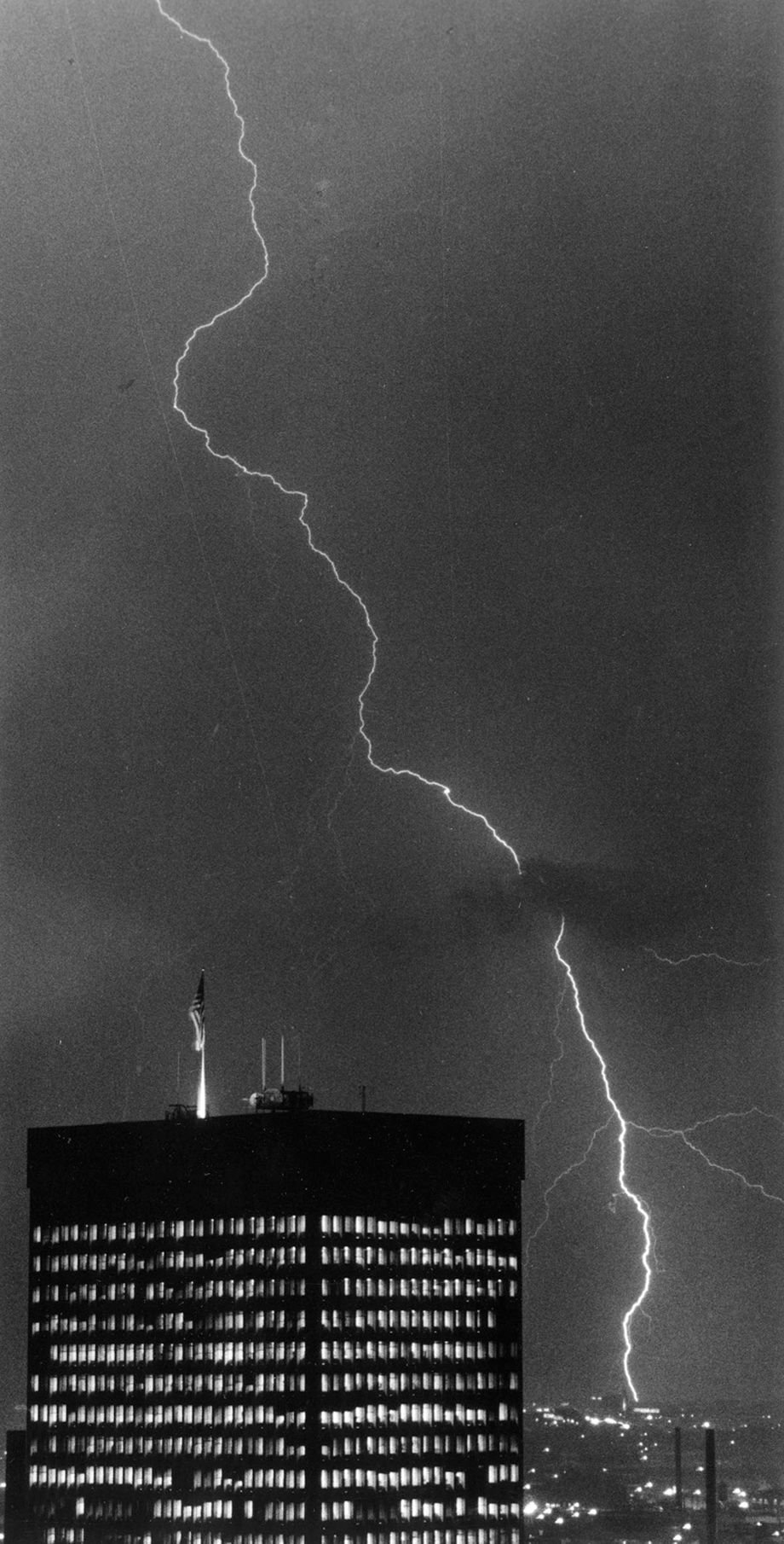
07-31-1985 (cutline): Bolt jolt--So that's where they get it! The Virginia Electric and Power Co. building in downtown Richmond was in the foreground of this line of lightning last night. The storm brought .22 inches of the day's .86 total rainfall, according to National Weather Service.
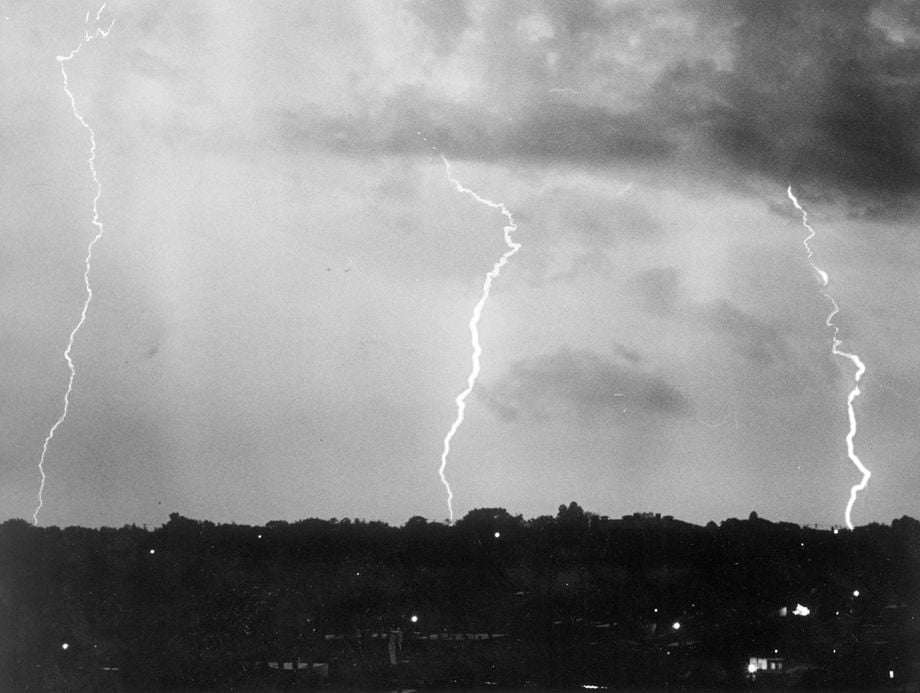
10-02-1954 (cutline): Three snake-like prongs of lightning stab earthward through darkening sky. These were heralds of thunderstorm that gave city first good dousing in 12 days.
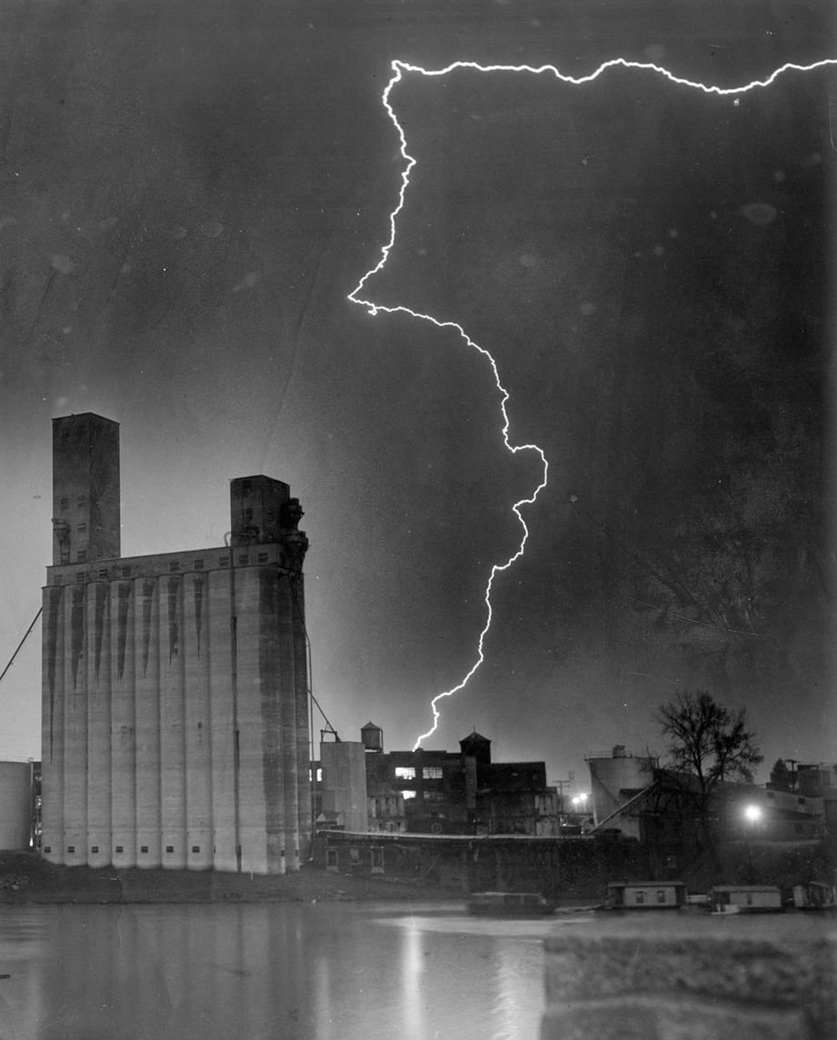
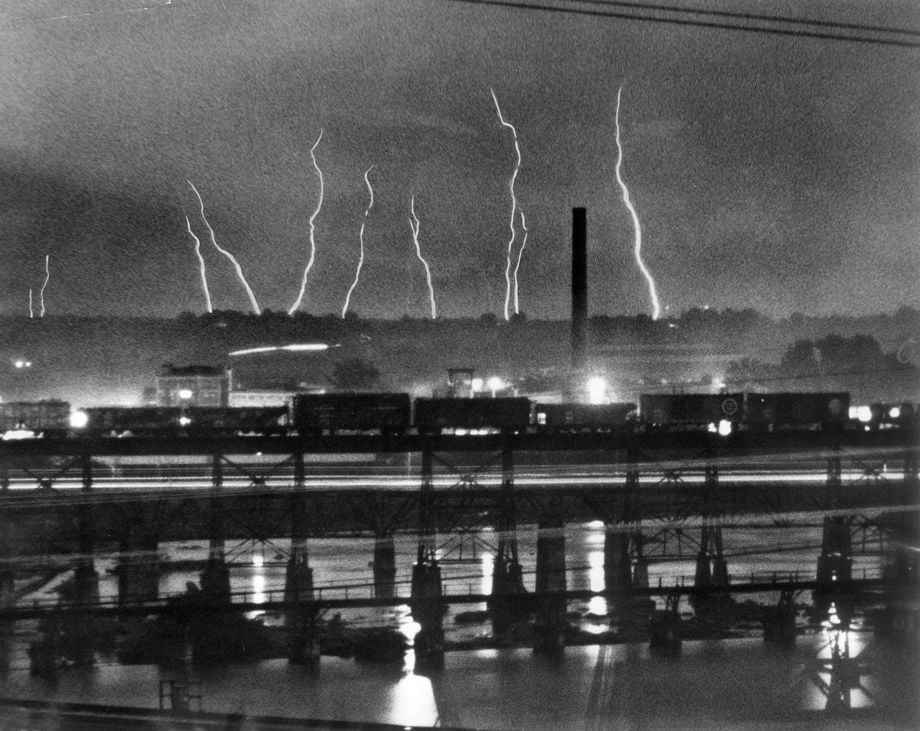
09-13-1953 (cutline): Zigzag lightning crackles over grain elevator on South Side of James River. Storm brought heavy rain and stiff gusts of wind to city last night.
07-30-1952 (cutline): Storm that broke city's heat wave gives a lightning display along the James.

Kayaking through dense fog in the James River just west of the Huguenot Bridge, Eric Miles (left) and Chuck Wrenn head for a favorite fishing spot Sunday morning. Wrenn said, "We fihured we'd come out here and wet a line and see what happens." Of the fog, he said, "You gotta go when the time permits."
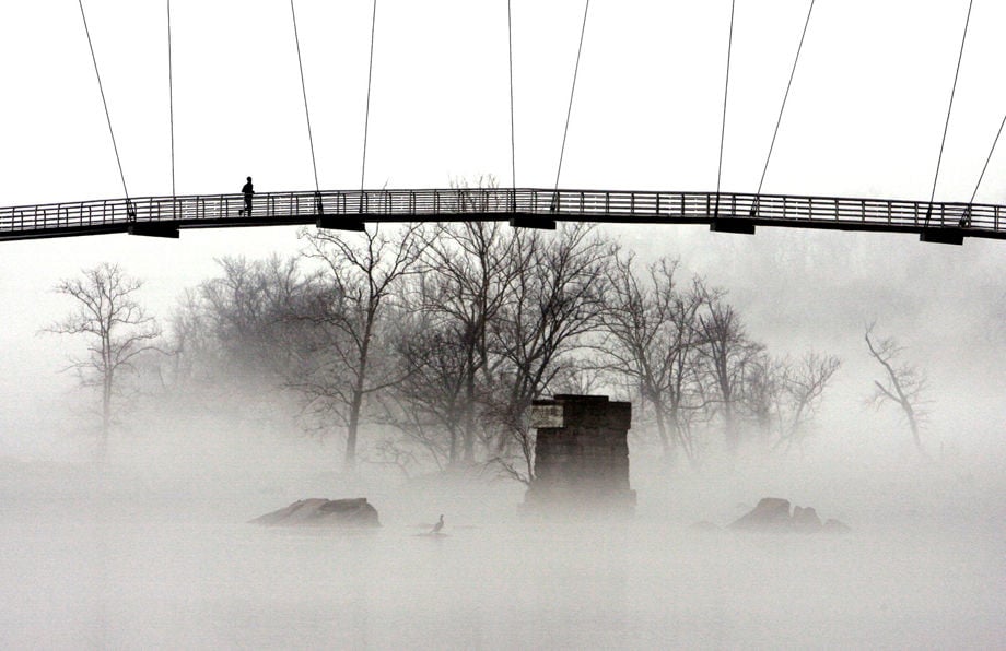
A runner makes his way across the Belle Isle footbridge Wednesday afternoon. LIBRARY NOTE; ABOVE DENSE FOG
Workers walk along a section of Government Road in Richmond, VA Tues. Aug. 31, 2004 surveying damage caused by heavy rain from remnants of tropical storm Gaston. NOTE: GASTON
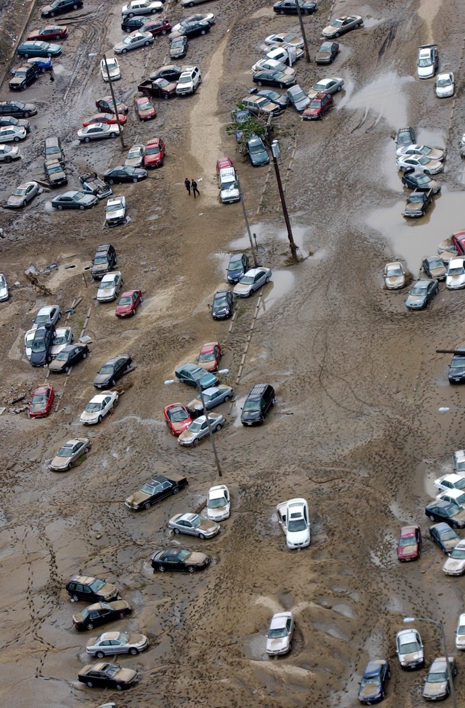
Cars remain in a parking area in Shockoe Bottom Tues., Aug. 31, 2004 after remnants of tropical storm Gaston caused flooding in Richmond, VA. NOTE: GASTON
A car remains buried in a parking area in Shockoe Bottom Tues., Aug. 31, 2004 after remnants of tropical storm Gaston caused flooding in Richmond, VA. NOTE: GASTON

Falling Creek as seen from the air Tues,, Aug. 31, 2004. NOTE: GASTON
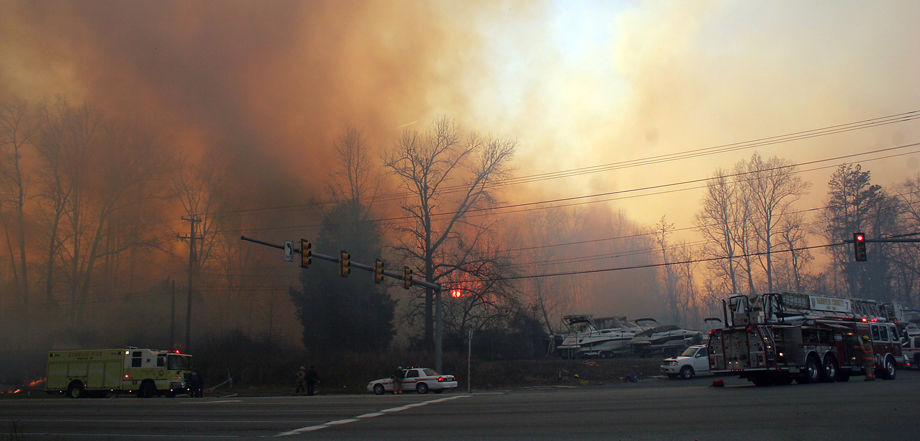
Firefighters battle a brush fire off Rt 1 near the Henrico Hanover line . Feburary 11 , 2008
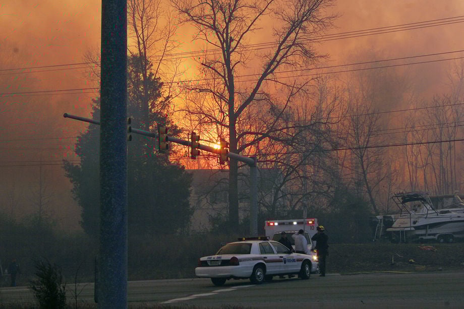
Hanover authorities block Rt. 1 at the scence of a brush fire on the Henrico Hanover line . Feburary 11 , 2008
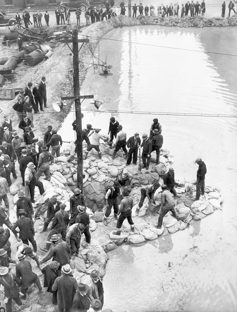
04-27-1937 (cutline): Sand bags help keep river away--Nineteenth and Dock Street presented this scene yesterday. Several score men worked feverishly to strengthen the dyke, while a still larger crowd found entertainment on the sidelines.

Kayakers attempt to navigate the James River despite all the exposed rocks 8/16/99. DROUGHT
A trash truck is stuck in flooding water on Charles City Road near Glen Aiden Drive in Henrico, VA, on Friday morning, June 22, 2018.
Barrett Maddox and her son, Brighton, 6, check out a vehicle stuck in floodwater near the intersection of Gayton Road and Cedarbluff Drive in Herico on Friday, May 18, 2018.
Police blocks Greenwood Road, which is flooded by Chickahominy River, in Glen Allen on Friday morning, May 18, 2018.
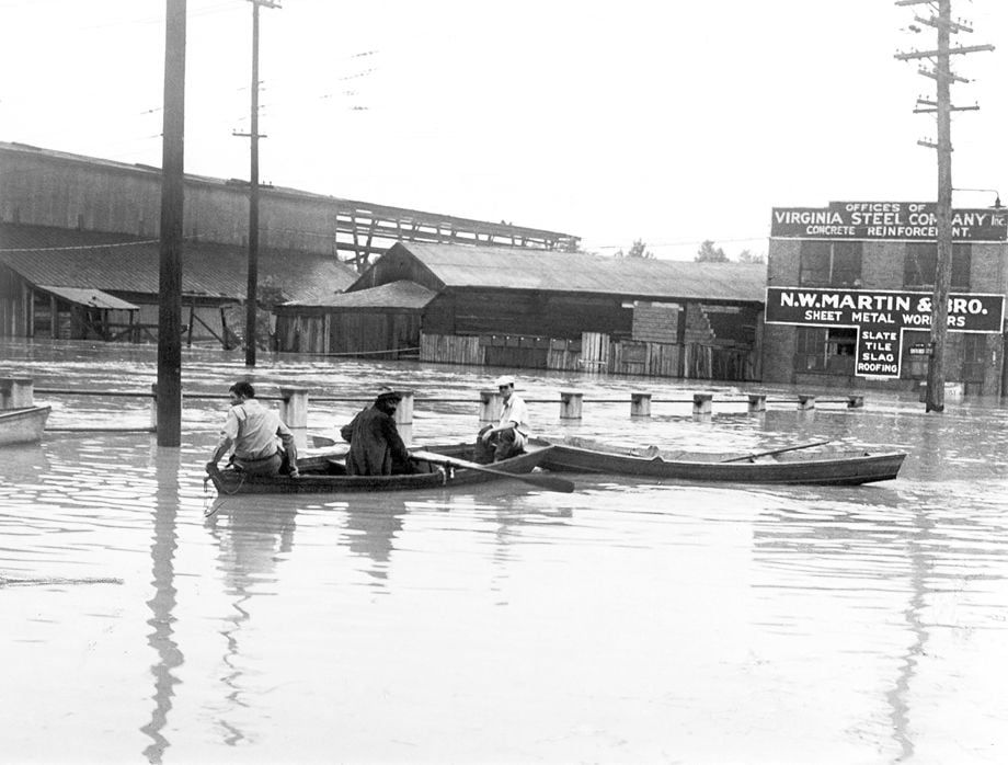
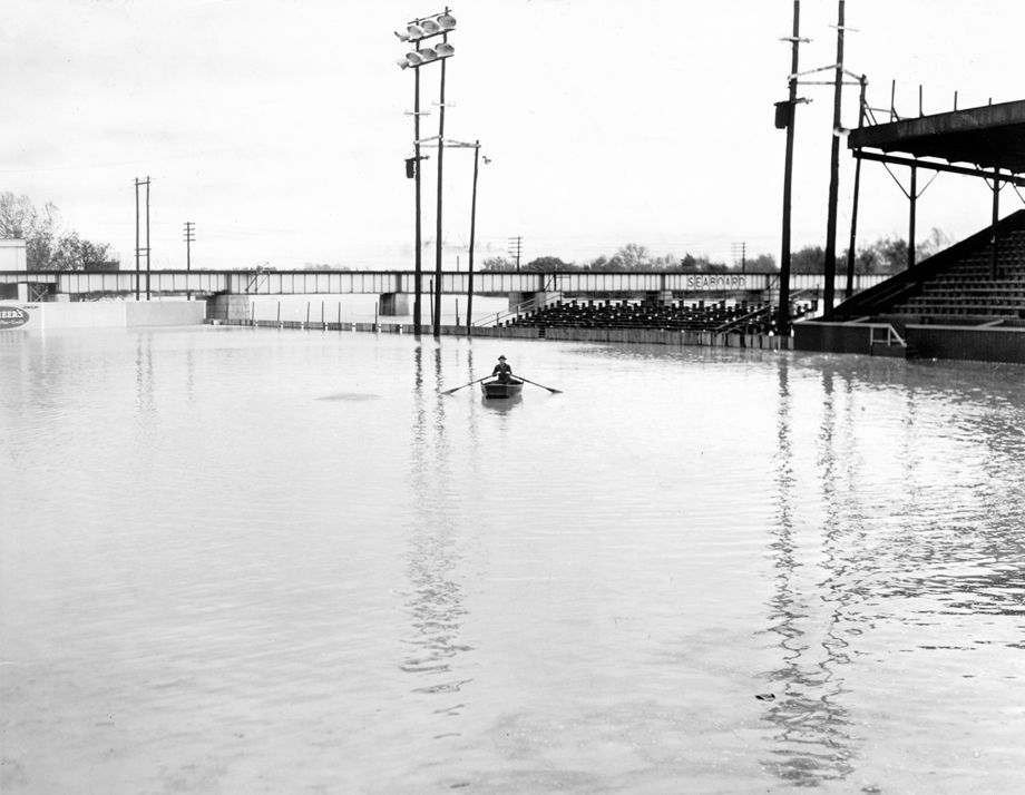
In September 1935, three men used small rowboats to navigate over a submerged bridge at 17th and Dock streets in Richmond. Storms, wind and flooding caused major damage in the city and surrounding localities, and the James River crested at about 26 feet.

Brenda Adams, whose family has owned the property arounf the Mechanicsville Flea Market for 45 years, stands outside of her flooded market on Tuesday, August 31, 2004. The flood waters of the Chickahominy River, swollen by Tropical Depression Gaston, caused widespread flooding and damage in Richmond and the surrounding counties.
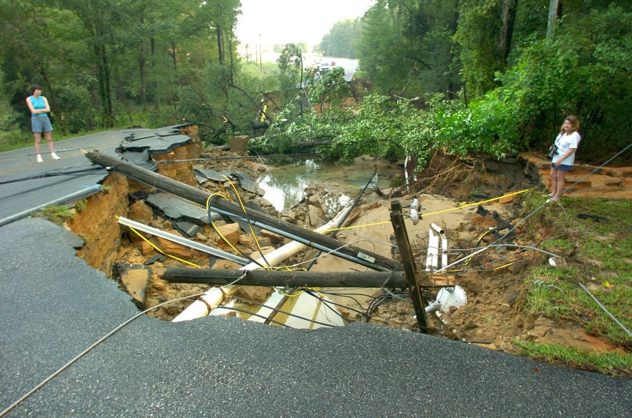
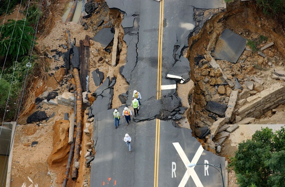
Residents of homes along Shady Grove Rd. in Hanover County look over a missing 100 foot section of the road on Tuesday, August 31, 2004. Flood waters from tropical storm Gaston caused widespread damage in central Virginia.

White Oak Road was still closed Wednesday, September 1, 2004, after the Chickahominy River overflowed its banks from heavy rains from remnants of Tropical Storm Gaston.
Downed power lines block Cogbill Rd in Chesterfield County . Tropical Storm Gaston dumped more than 10 inches of rain on the Richmond area . August 31 , 2004
Rainwater from Tropical Storm Gaston washed out sections of Hopkins Road at the Falling Creek Reservoir in Chesterfield County . The storm dumped more than 10 inches of rain on the Richmond area . August 31 , 2004
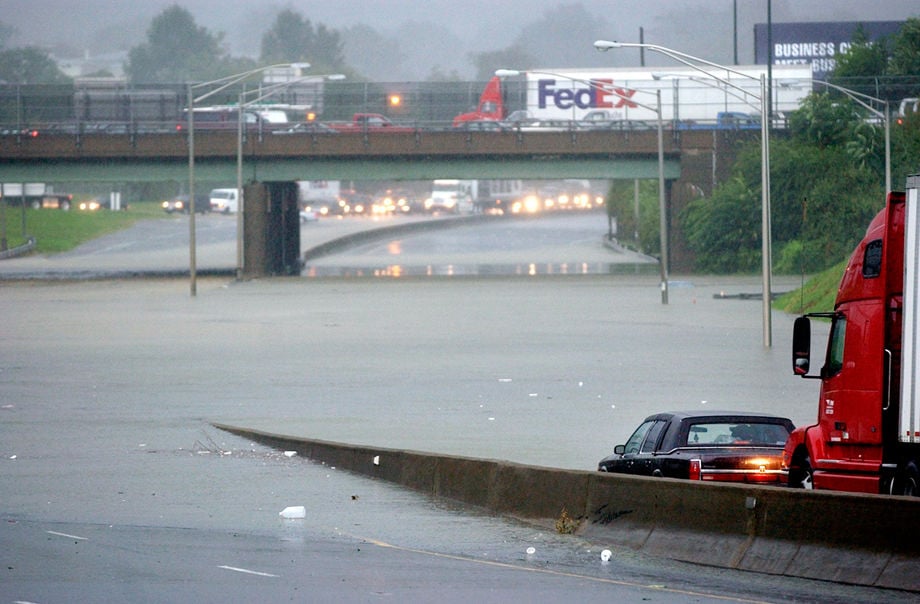
Interstate 95 is closed under the Belvidere overpass in downtown Richmond, as rising floodwaters forced motorists in both directions to exit onto local streets causing gridlock on Aug. 30. 2004. The remnants of Tropical Storm Gaston battered central and southeastern Virginia with heavy rain and strong winds.
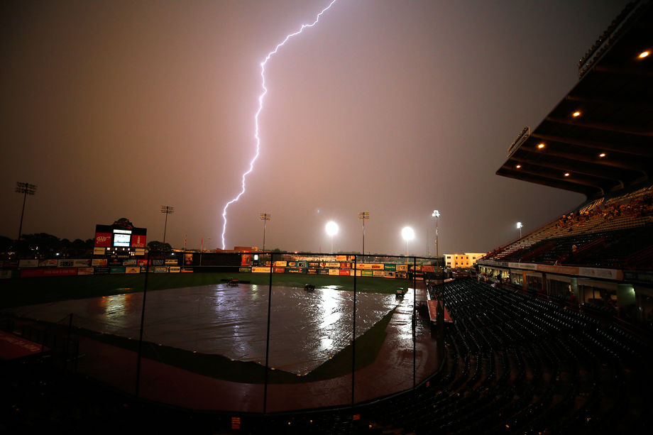
A thunderstorm and lightning passes over the Diamond during a game between the Richmond Braves and the Ottawa Lynx on May 23, 2005. The game was delayed because of the rain.

Storm clouds swirl over downtown Richmond, VA Friday, August 21, 2009, as a line of thunderstorms moves through the central Virginia area.
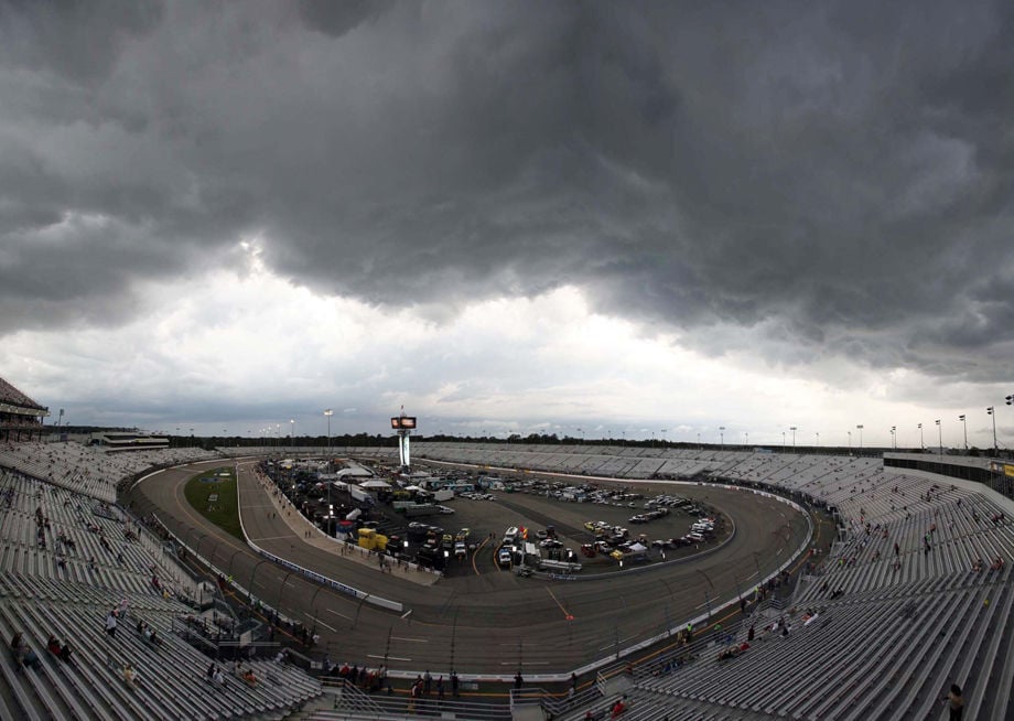
Storm Clouds hover over RIR track before the Federated Auto Parts 400 Saturday, September 8, 2012 at Richmond International Raceway in Richmond, Va.
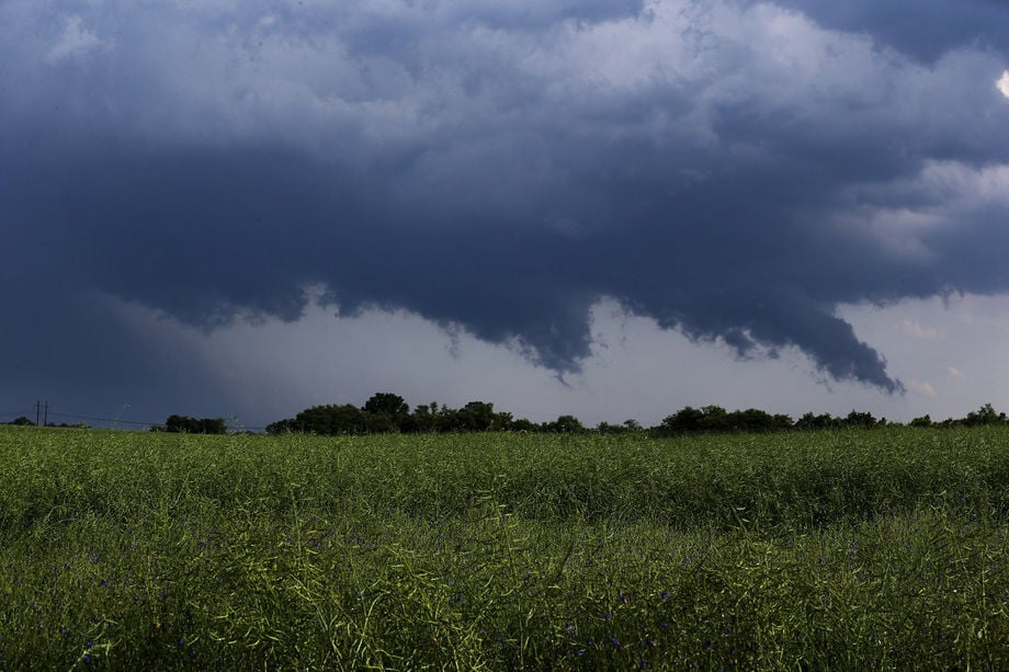
Storm clouds swirl over a field of canola in eastern Henrico County, VA Thursday, May 22, 2014 as strong storms sent creeks out of their banks, dumped hail and downed trees with high winds.
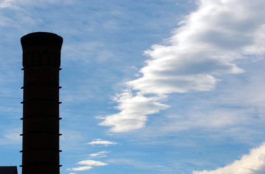
Clouds pass over Tredegar Iron Works Monday, December 1, 2003.
Rain cloud roll over downtown Richmond on Tuesday afternoon, June 18, 2013
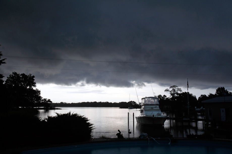
Storm clouds hover over Antipoison Creek near Whitestone, VA Saturday, July 14, 2012.

Dark clouds form during Richmond International Dragon Boat Festival at Rocketts Landing in Richmond on Saturday, August 10, 2013.
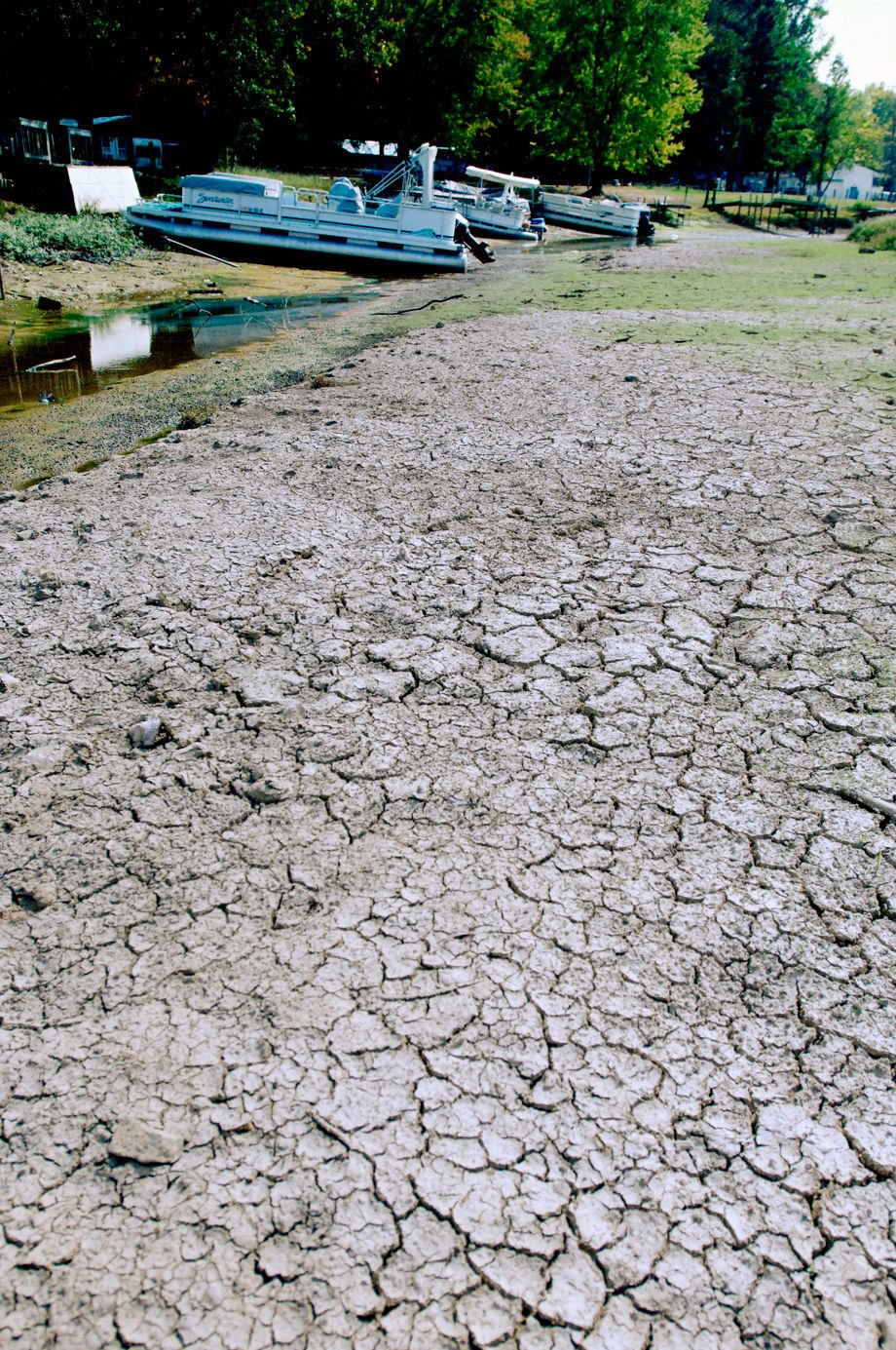
Lake Chesdin, low water 9/10/07. Low water at Cozy Cove.
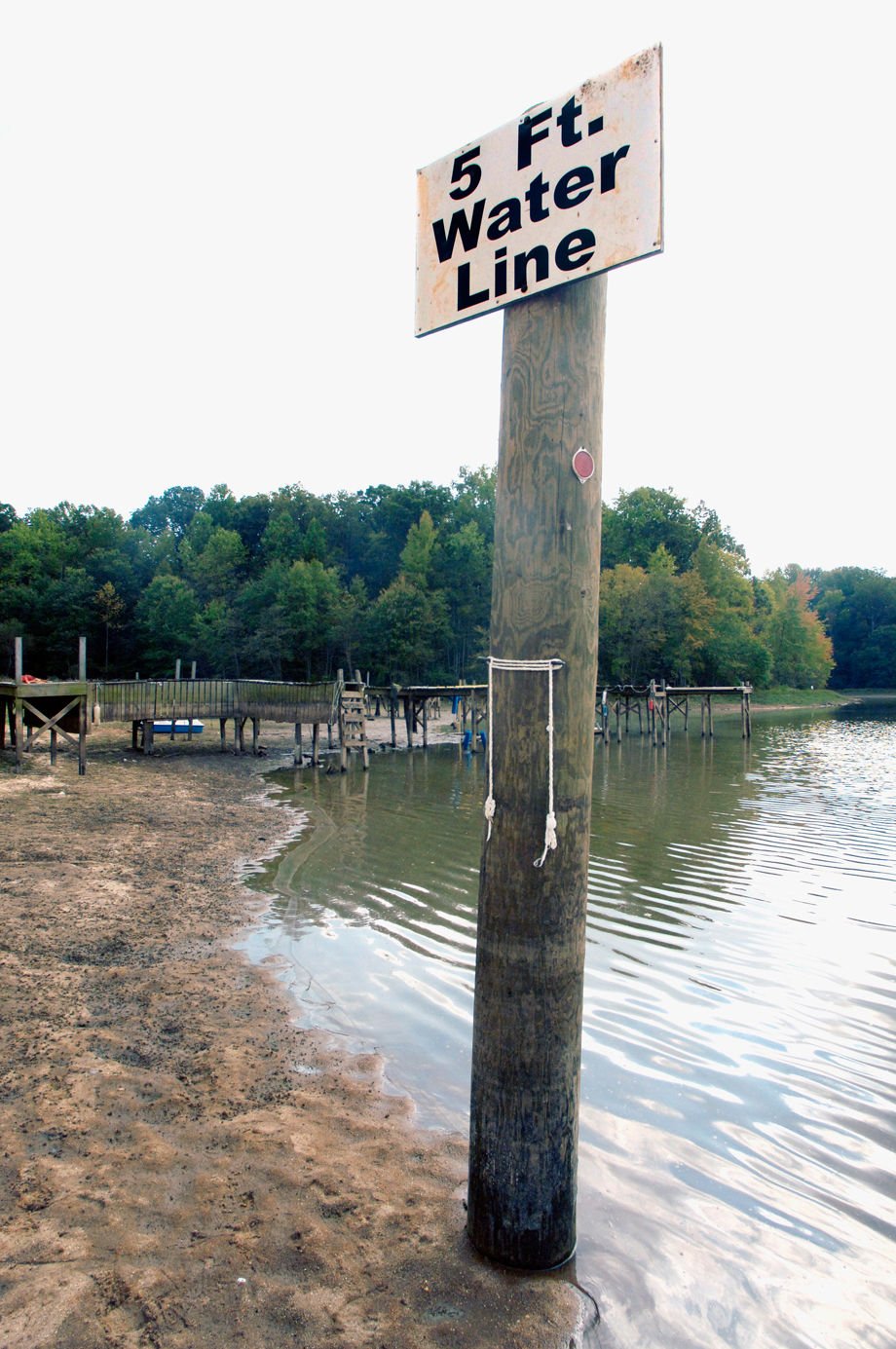
Lake Chesdin, low water 9/10/07. A water marker at Whipponock shows the water five feet low. NOTE The rope marks the 5 ft.

The drought's effect on the James River made it easier for this man to walk across the dam which leads to Williams Island from Riverside Drive. The dam, known as the "Z" dam, has no water flowing over it except for through this cut which was created to allow fish to swim upstream for spawning.
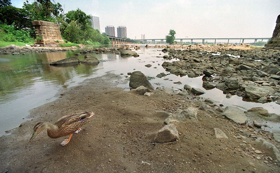
A single duck scouts for some grub in the exposed James River bed under the Lee Bridge in Richmond, Va. on Fri., Aug. 13, 1999. A late summer drought has the river at its lowest lewel in nearly sixty years.
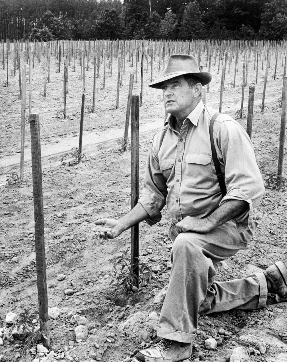
In May 1963, farmer H.R. Beadles lamented his tomato plants, which suffered from a prolonged drought that had spread across Virginia. “I’ve never seen a drought as bad,” he told a Richmond News-Leader reporter.

A helicopter flies over a Chesterfield county brush fire near Rt. 288 and the Chesterfield County airport Wed. April 10, 2013.
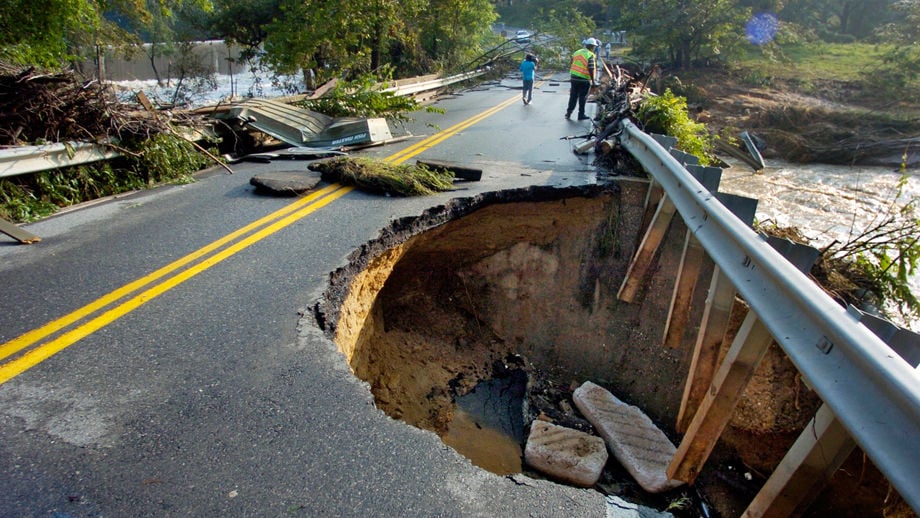
Braxton Moore, with Hanover County Public Utility, checks on the status of a water line on Route 54 west of Independence Road in Hanover County after one lane was washed away after heavy rains this week. Photo was taken on Saturday, May 19, 2018.
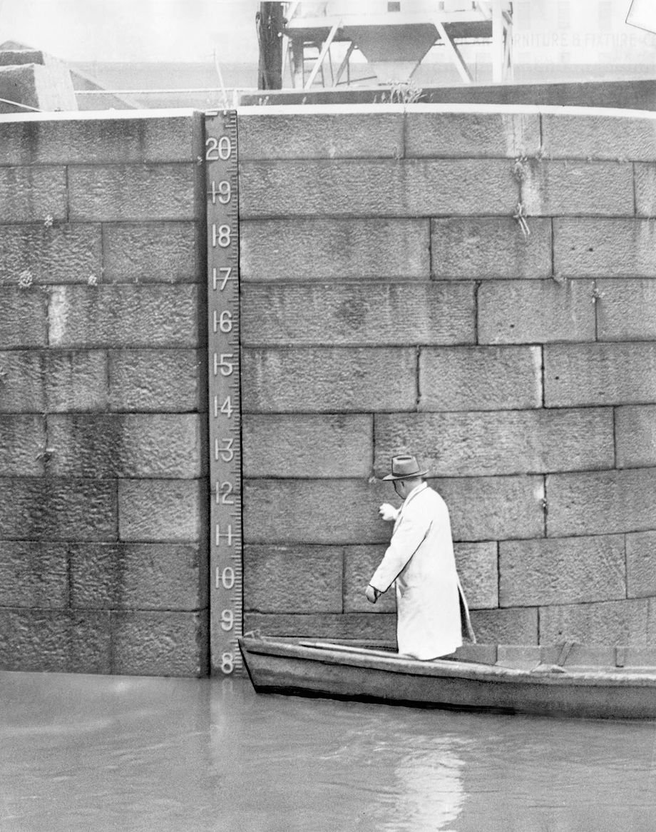
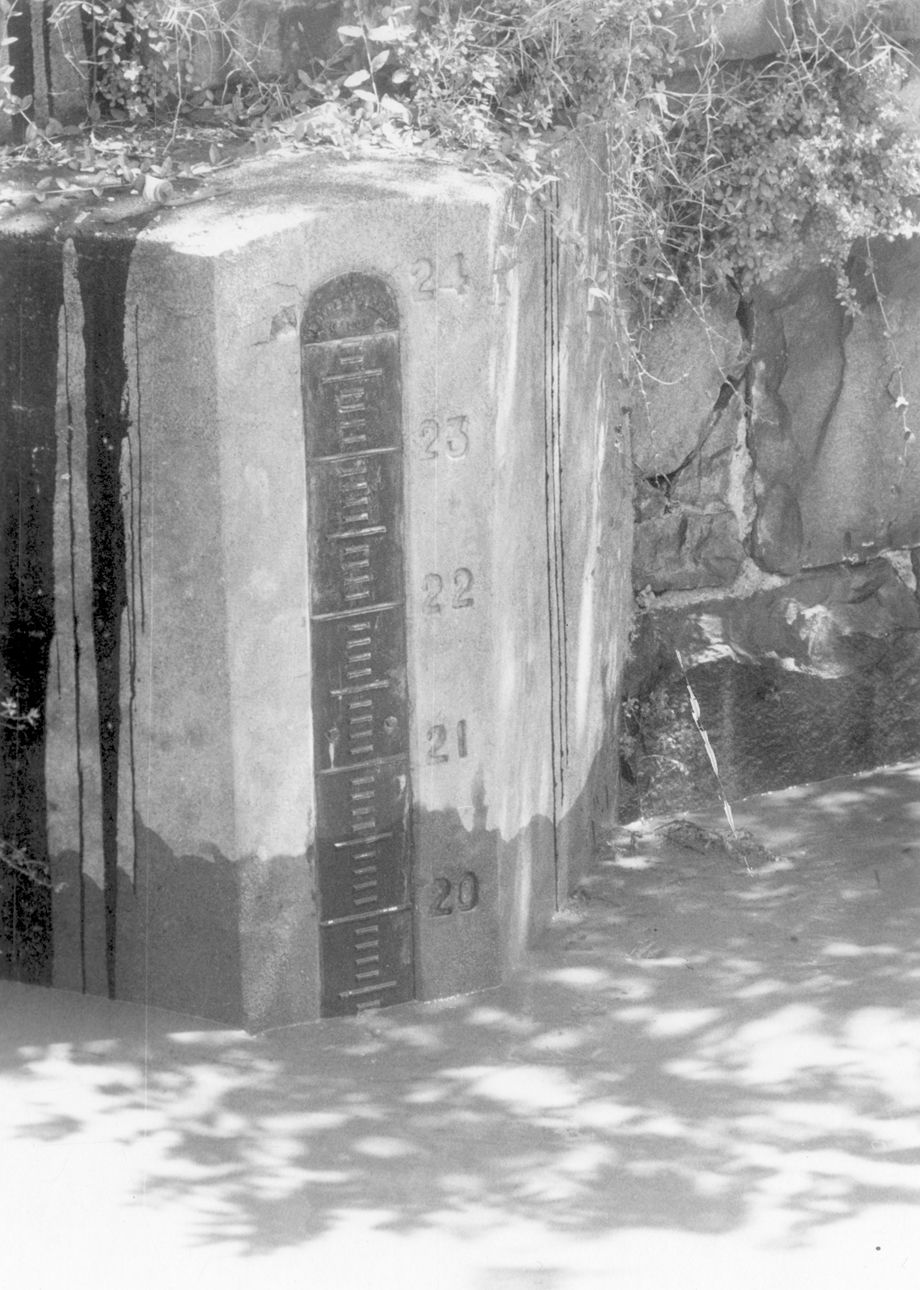
In April 1952, Richmond harbormaster O. L. Rowe checked the gauge on the James River as the water approached flood stage after four days of rainfall. Flooding was only minor in several sections of the city.
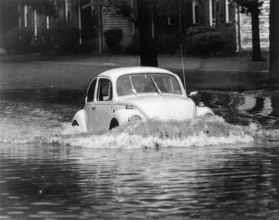
In June 1969, drivers navigated a flooded Westover Hills Boulevard in South Richmond after heavy rainfall.
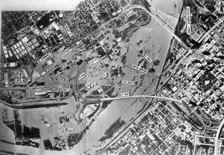
November 1985 flood
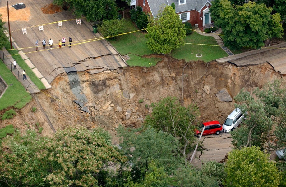
Heavy rain from the remnants of Tropical Storm Gaston caused a sinkhole at 31st and East Grace streets in Richmond on Aug. 31, 2004.
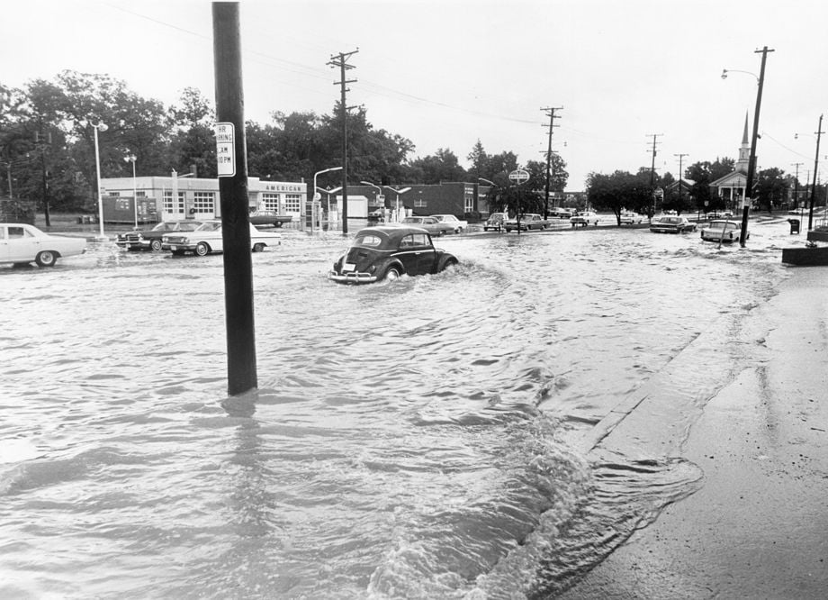
In late May 1972, a Volkswagen Beetle made its way through deep water in South Richmond. Heavy rains the day before caused flash flooding and closed many roads in the Richmond area. The rainfall led to a local monthly record for May at 8.87 inches.
This elevated portion of the Downtown Expressway in Richmond became filled with rainwater during the heavy rains of June 21, 2012. Photo taken from a fifth floor window of a turning basin building. Photo by Anna Kuta
Fog rolled down the James River as storm clouds loomed overhead during what was an unseasonably warm January day. January 7, 1998.
Fog hovers over Richmond 1/7/98. picture taken from Church Hill.

Fog covered Richmond's skyline Wednesday morning, November 24, 1999.

With the arrival of cold air, mixed with relatively warm water, fog forms on the James River in the lower rapids of Pony Pasture. The Carillon tower is in the background.

Fog covers the James River across from Pony Pasture Monday afternoon, January 15, 2013.
Fog obscures the view of the James River from Riverside Drive Monday afternoon, January 15, 2013.
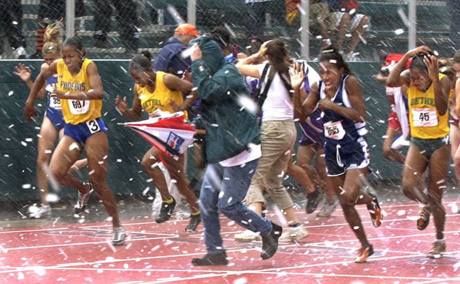
Participants in the Group AAA state track meet run to get out of a sudden hailstorm which halted the events for about a half hour at the Sports Backers Stadium. A girls' race was about to begin when the hail started.
6-22-1972: Floods - Richmond
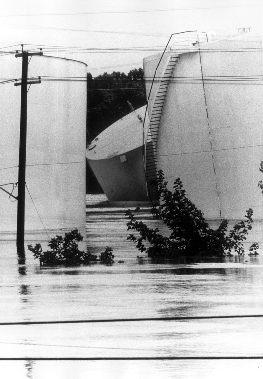
6-24-1972 (cutline): Fuel oil tanks at Maury Street were upset by flooding
Hurricane Agnes Floods. 1972 FILE PHOTO Fredericksburg
Hurricane Agnes Floods. 1972 FILE PHOTO Scottsville
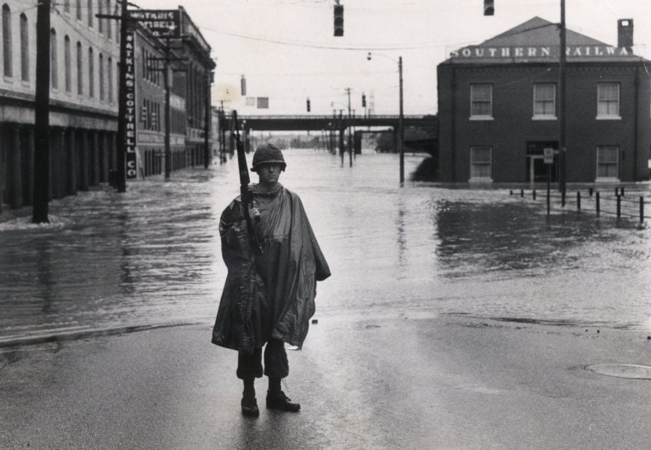
HURRICANE AGNES 1972 June 23, 1972 - Photographer Mike O'Neil - June 23, 1972 Virginia National Guard member Rob Snellings. - Virginia National Guardsman stands on flooded 14th Street in view looking South. Troops and police did their best to channel traffic around the flooded areas of Richmond, Va. in Shockoe Bottom.
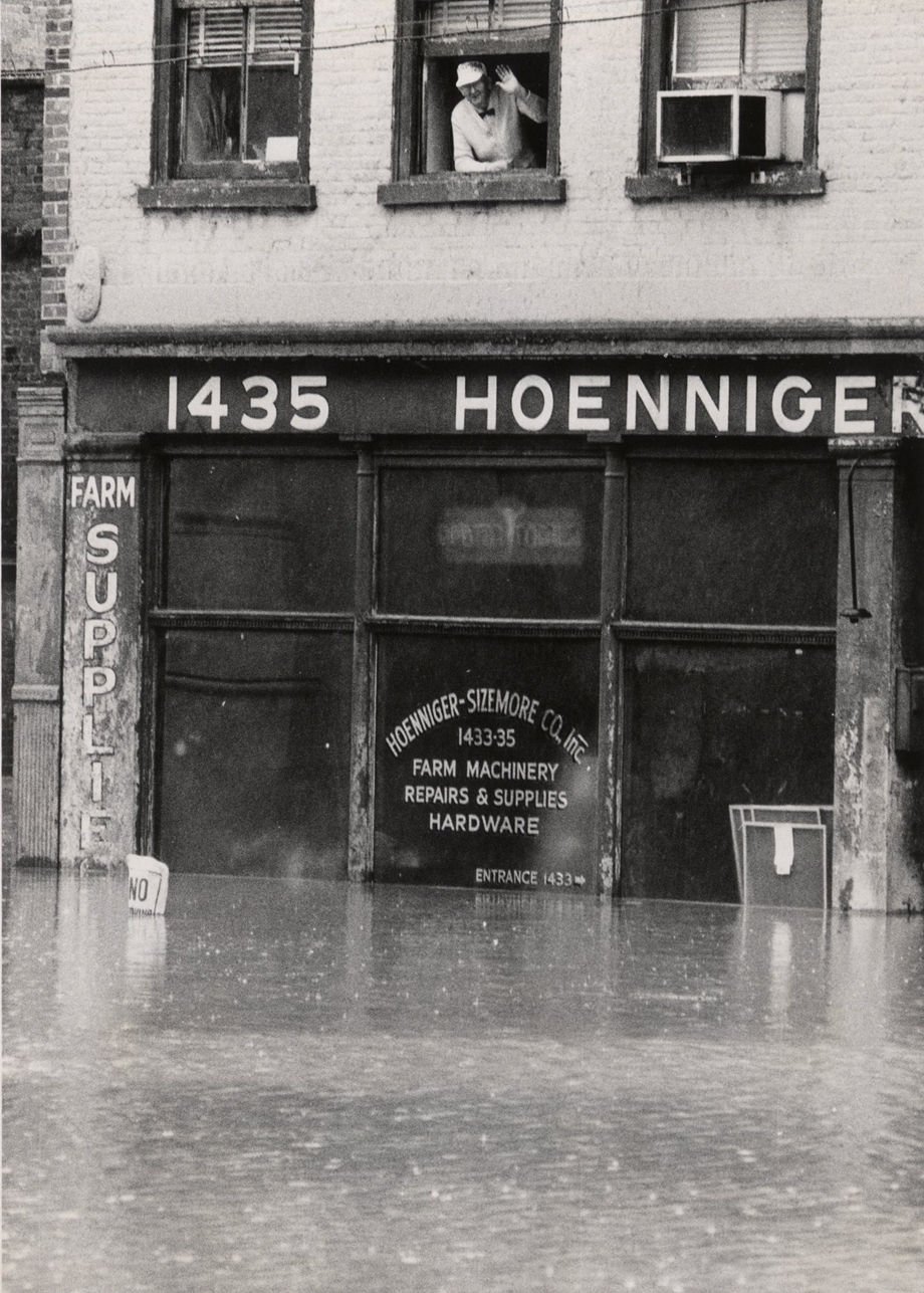
HURRICANE AGNES 1972: June 23, 1972 - Photographer P. A. Gormus, Jr. Flooding in Richmond, Va. cutline) "Seemingly unworried, man waves from window at 1435 East Main St. (Shockoe Bottom)
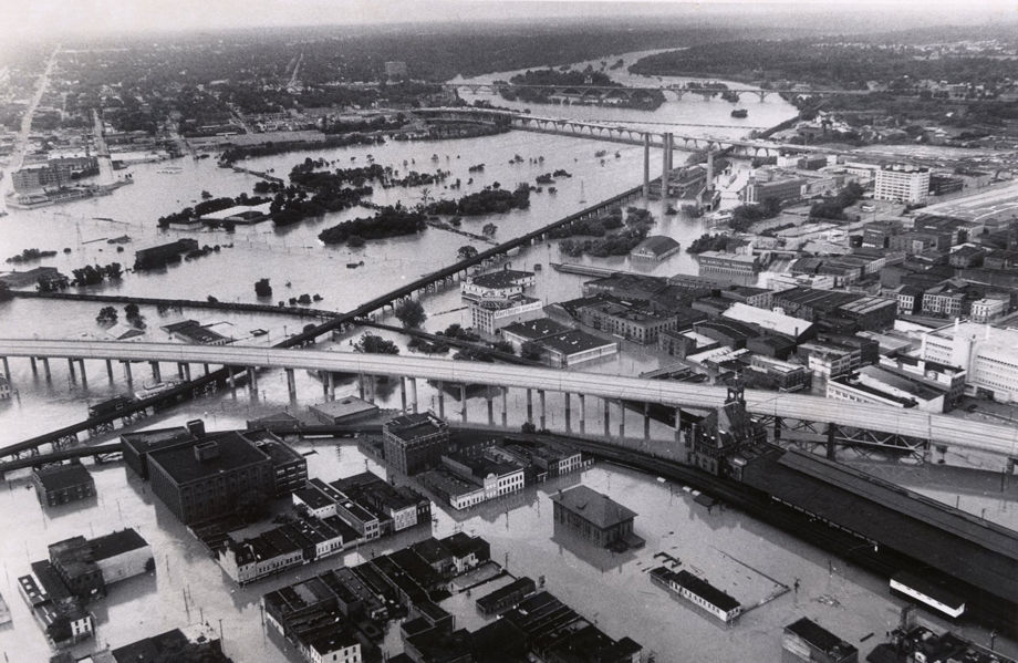
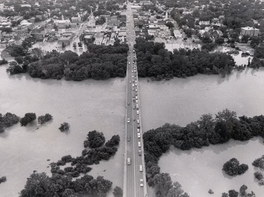
HURRICANE AGNES 1972: June 23, 1972 Overview of city (looking West) shows widespread flooding; Interstate 95 in middle of Photo.
HURRICANE AGNES 1972: June 22, 1972 Photographer Bob Brown - Rappahannock River flooding in Fredericksburg Va.
HURRICANE AGNES 1972: June 22, 1972 Photographer Bob Brown - (cutline) High waters from the Rappahannock River caused this flooding in Fredericksburg, Virginia.
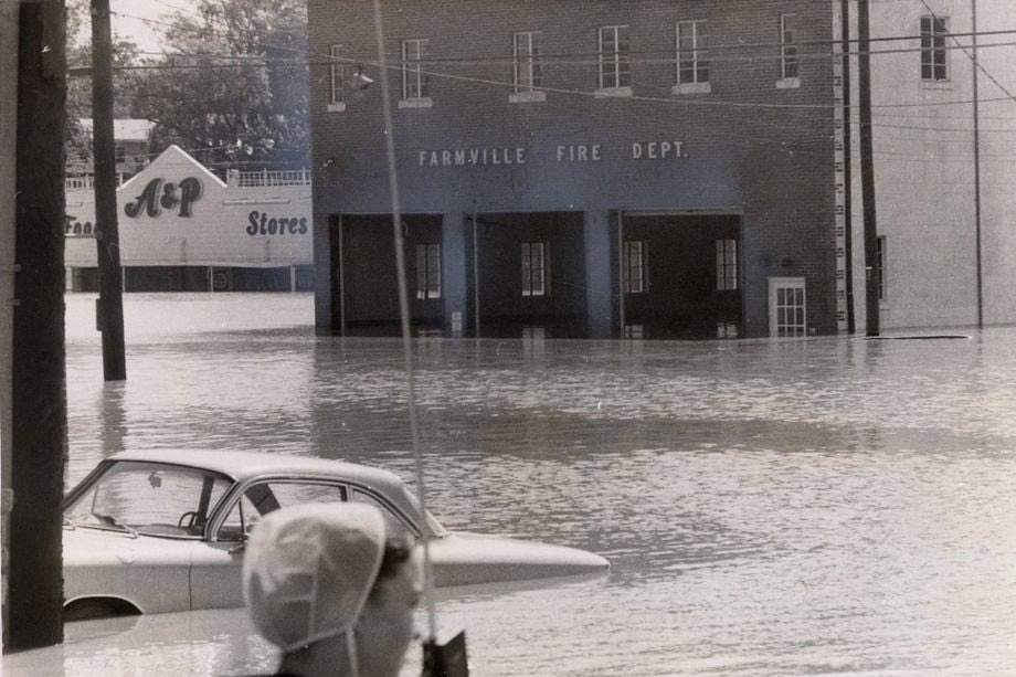
HURRICANE AGNES 1972: June 23, 1972 Photographer " T.D. News Bureau Photo " - (cutline) Very little in Farmville escaped the fury of the Appomattox River as the town experienced its worst flooding
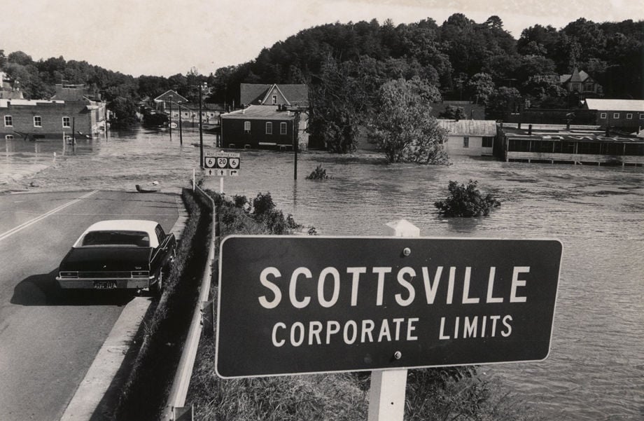
HURRICANE AGNES 1972: June 22, 1972 Photographer Amir M. Pishdad. - Flooding by the James River in Scottsville Va.
HURRICANE AGNES 1972: June 22, 1972 Photographer Bill Lane - Flooding of Main Street Station, Richmond Va. Photo taken from Interstate 95.

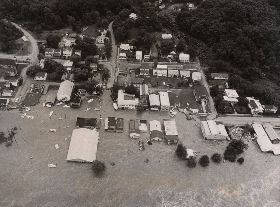
HURRICANE AGNES 1972 : June 22, 1972 Photographer Bob Brown (cutline) This is the way Scottsville, Va. on the northernmost bend of the James River, looked from the air today as flood waters moved from the mountains of southwestern Virginia toward the Atlantic Ocean. Most of the Scottsville business district was under water. The river was expected to crest in Richmond about 6 a.m.
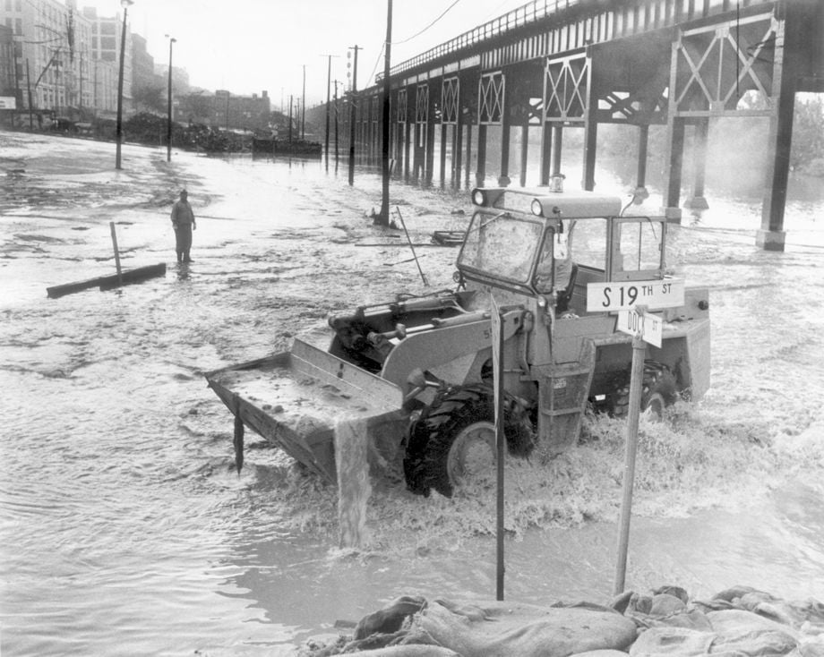
Flooding from Camille, August 1969. Cutline (8-23-1969): City workmen make a start on heavy mud deposits at 19th and Dock Streets.
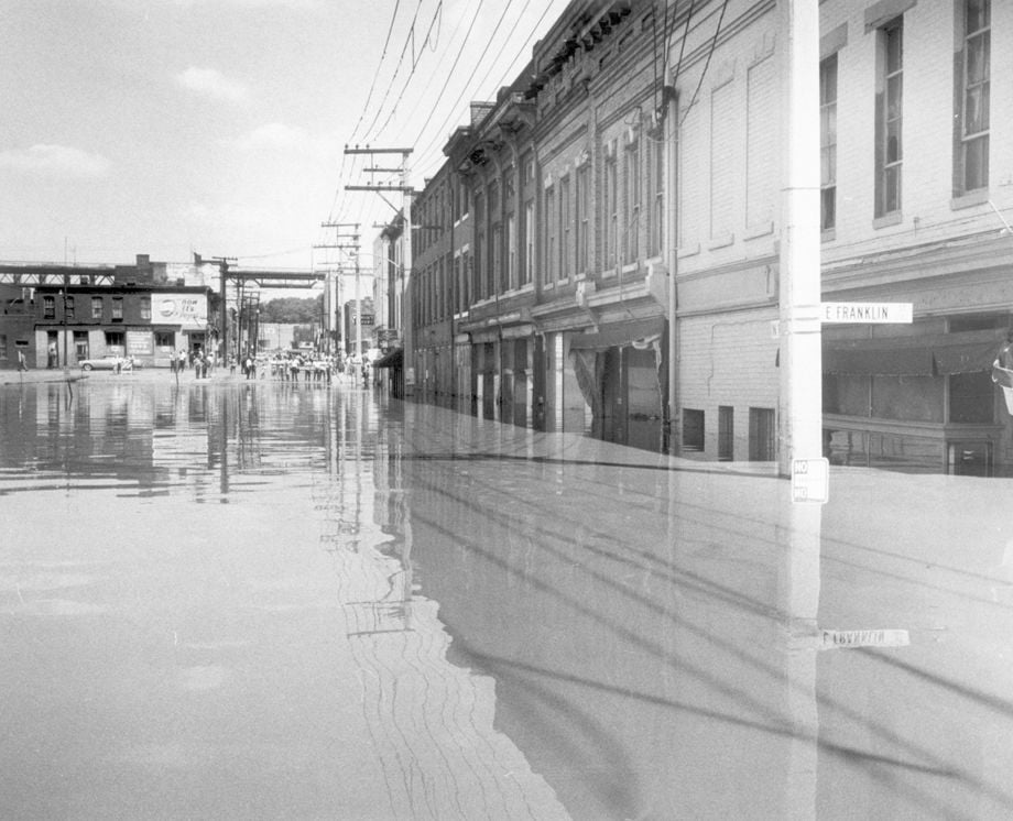
Flooding from Camille, August 1969. Franklin St.
Flooding from Camille, August 1969. Belle Isle bridge shot from North end of Lee Bridge
Flooding from Camille, August 1969

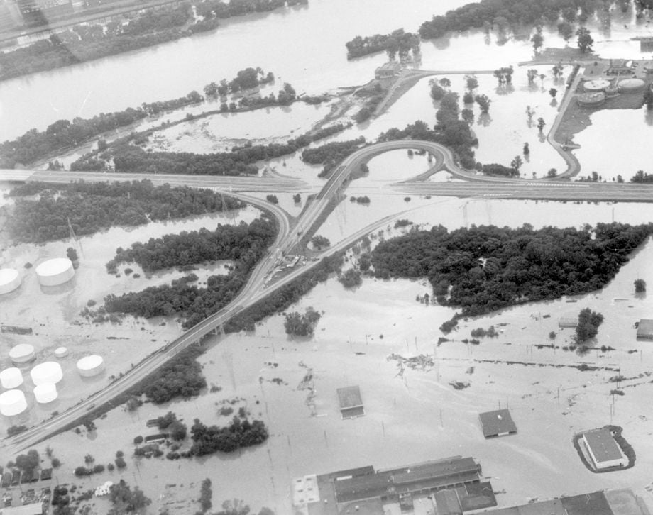
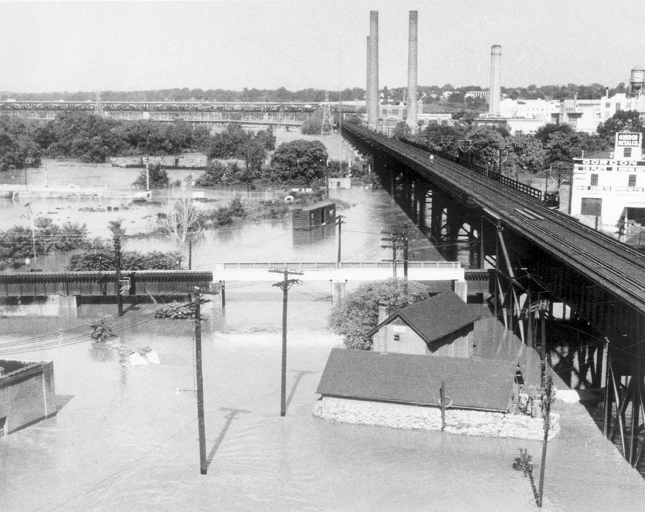
Flooding from Camille, August 1969. Aerial Photo. Cutline (8-23-69) - Flooded Maury Street Exit on Interstate 95, looking Northeast early yesterday.
Flooding from Camille, August 1969. Spectators seem fascinated by the flow at 16th and Main Streets. Looking East from 16th & Main.
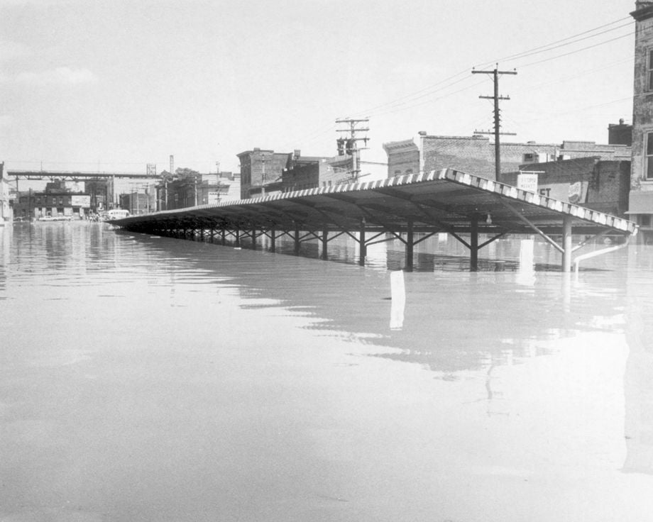
Flooding from Camille, August 1969. Market shed on 17th St.
Flooding from Camille, August 1969. On 17th St.
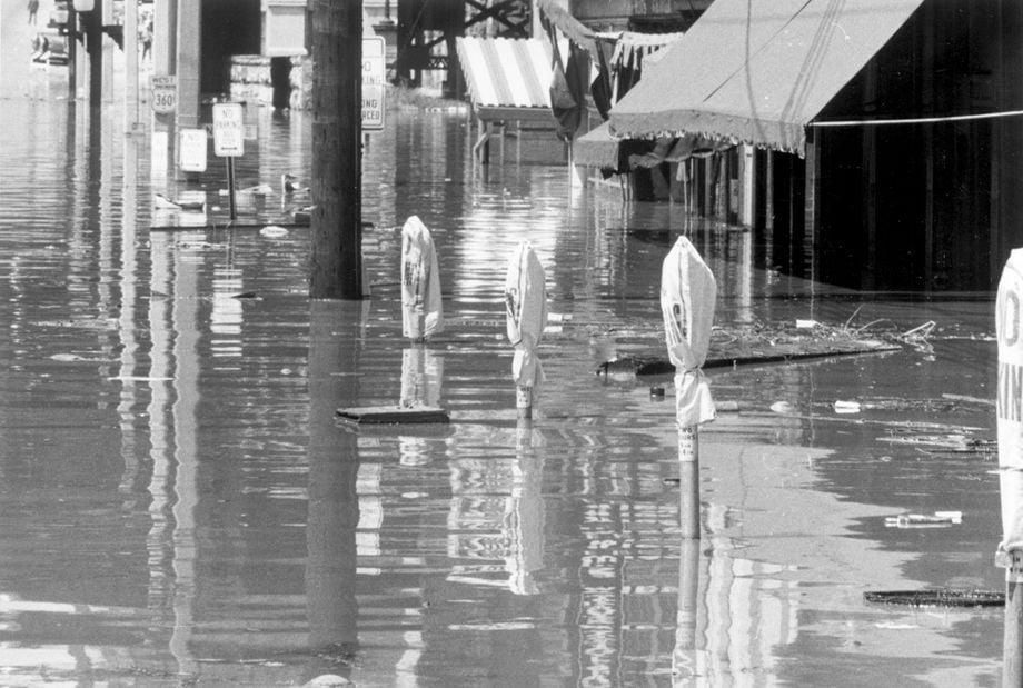
Flooding from Camille, August 1969. Meters in 1700 block E. Main St.
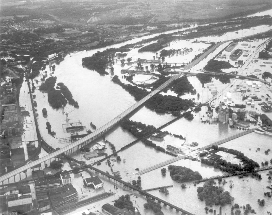
Flooding from Camille, August 1969. Aerial Photo. Maury St.
Flooding from Camille, August 1969. Cutline (8-22-1969): The James flows over parts of the I-95 and 14th street bridges.
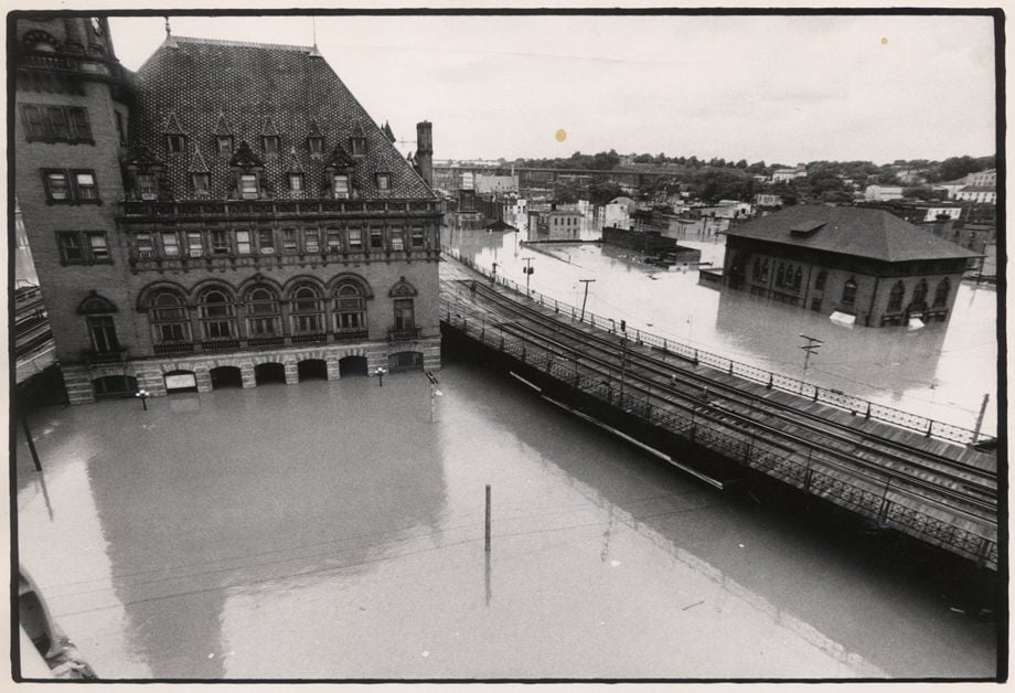
Flooding from Camille, August 1969. Dock Street and the 14th Street Bridge are viewed from the I-95 bridge.
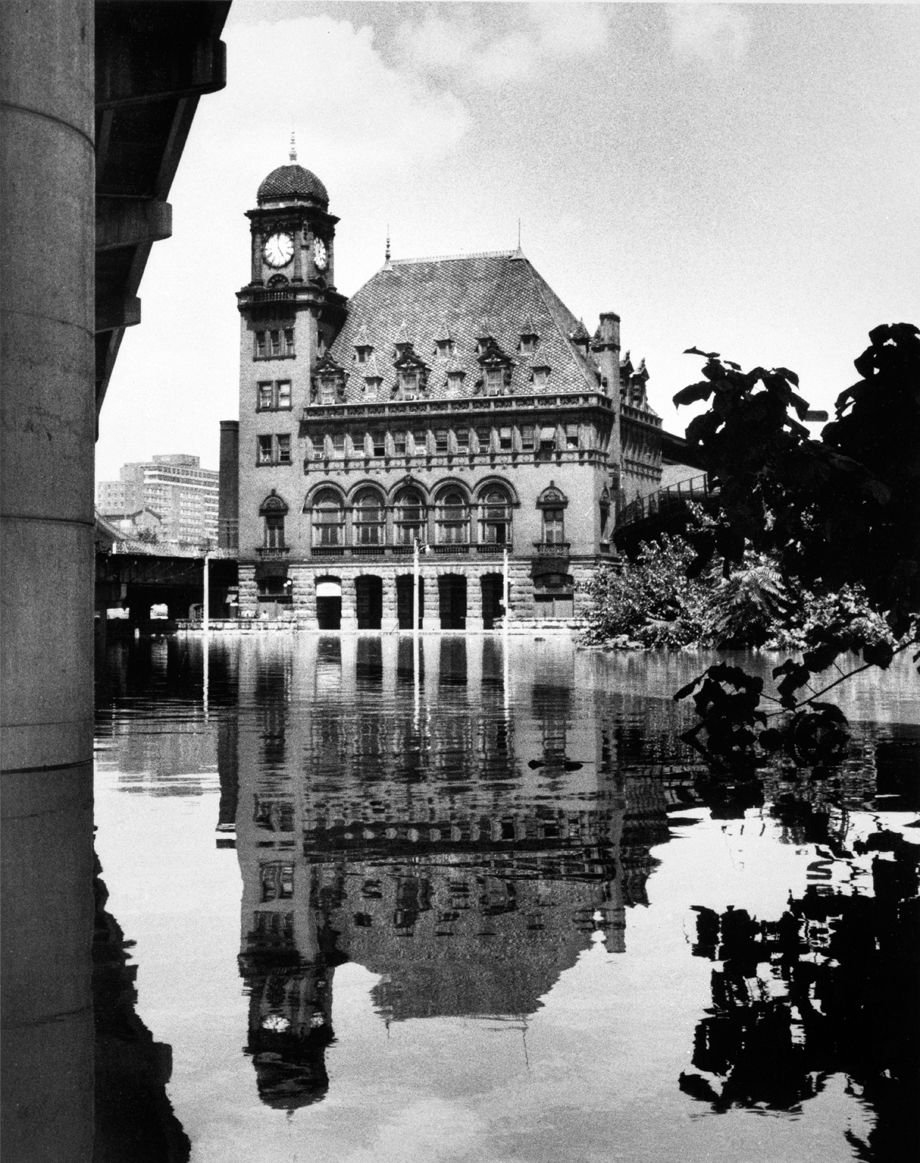
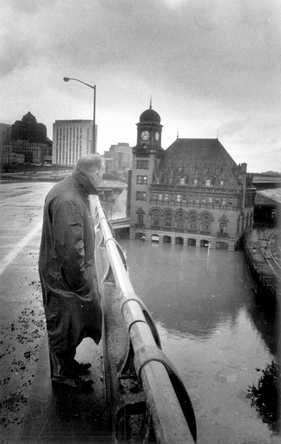
In August 1969, Main Street Station in downtown Richmond sparkled in the floodwaters left by Hurricane Camille. The James River peaked at 28.6 feet in the storm.
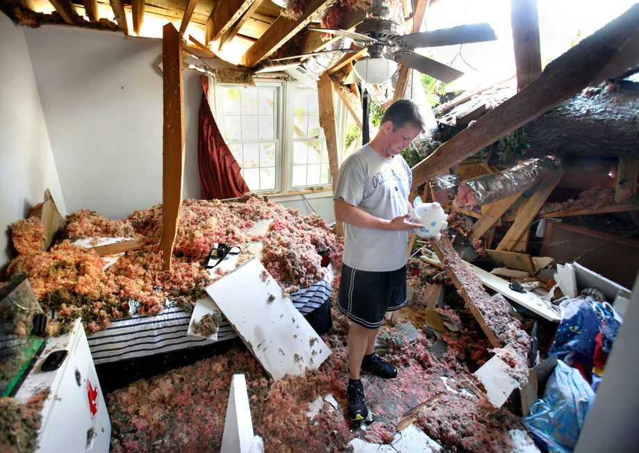
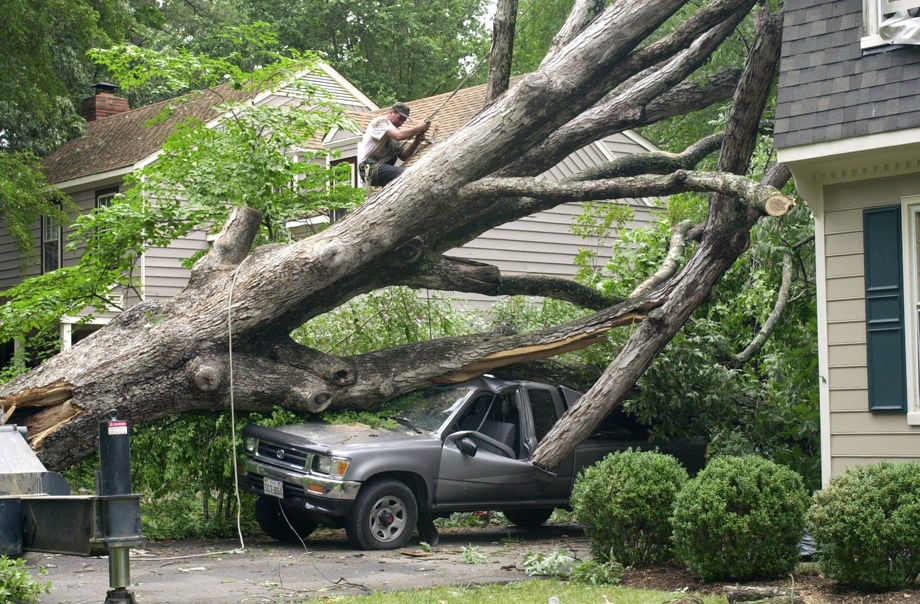
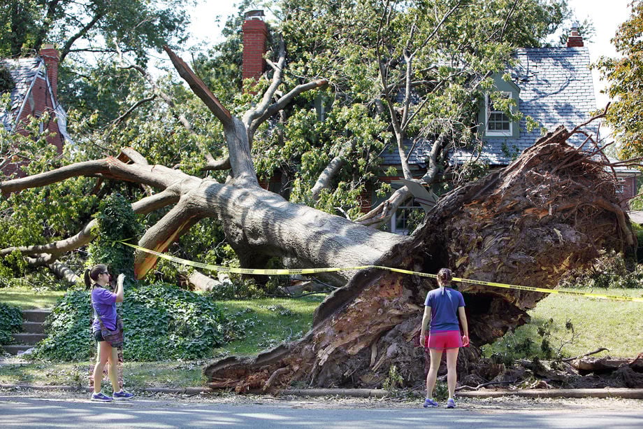
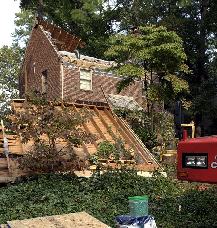
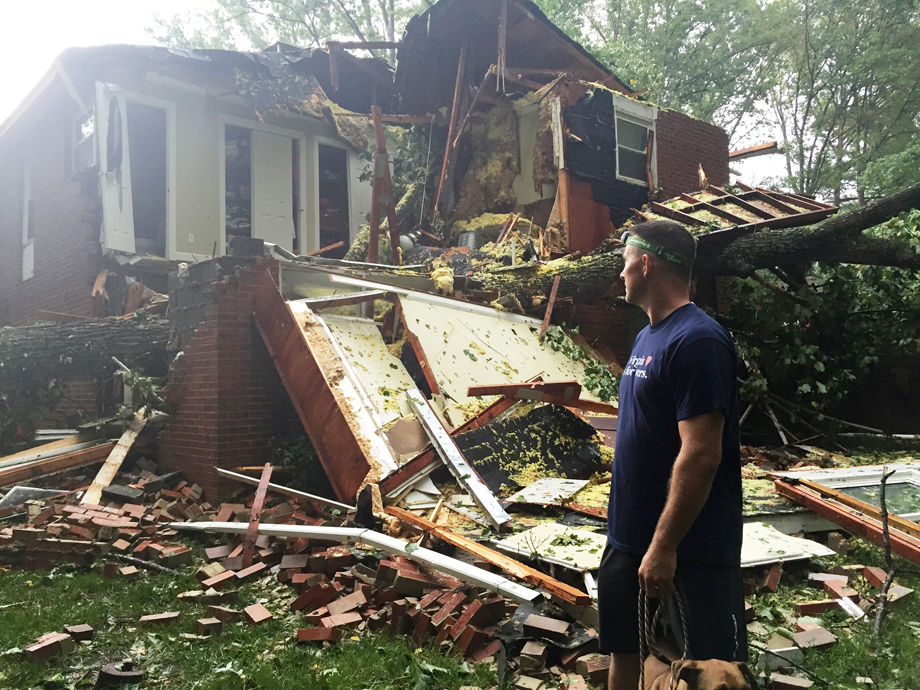
Joe DeLoria checks out a ceramic piggy bank that he recovered from the bedroom of his 8-year-old son, Evan, where a giant oak tree crashed through Saturday afternoon. The tree bisected a large portion of the Bon Air house, including DeLoria's bedroom. His wife, Amy, was in the basement when the tree hit, but had been napping there up until about two minutes before the tree fell. DeLoria and his children were in their neighbor's basement. The house is at 8624 Halstead Road.
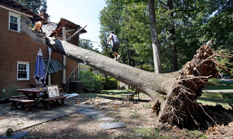
Bob Farinholt walks up a giant oak tree that fell onto the home of neighbors Joe and Amy DeLoria Saturday afternoon. The tree bisected a large portion of the Bon Air house, including Deloria's bedroom and the bedroom of son, Evan, 8. Amy DeLoria was in the basement when the tree hit, but had been napping there up until about two minutes before the tree fell. DeLoria and his children were in their neighbor's basement. The house is at 8624 Halstead Road.
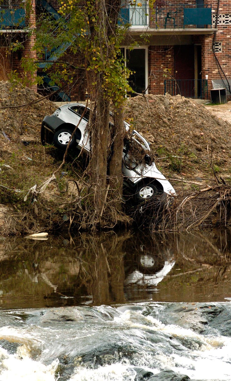
Weeks after excessive rain from Hurricane Gaston flooded this area of Falling Creek, cars which were swept downstream remain lodged on the bank of the creek.
JAMES RIVER CHURNS ALONG IN VICINITY OF LEE BRIDGE AFTER RISING FROM STAGNANT DROUGHT STAGE [Hurricane Hazel]
WRECKAGE ON WINDER STREET, WHERE FOUR ROOFS WERE BLOWN FROM BUILDINGS [Hurricane Hazel]
Baker Ellett walks his dogs, Aug. 27, 2011 in Richmond, Va. Hurricane Irene swept through central Virginia with unexpected force, leaving in its wake a forest of downed trees and limbs snapping power lines, crushing cars and smashing houses.
One of the homeowners at 4107 Patterson Avenue said many people walked by to take pictures of the tree that fell on her and her husband's home and a neighbor's house (at left) after Hurricane Irene came through Richmond last weekend. She did not want to give her name. Photo taken Thursday, September 1, 2011.
This home at 624 Wilmer St. near Henrico High School in Richmond, VA, was heavily damaged Tuesday, Sept. 23, 2003, after a tornado ripped through the neighborhood in the early morning. The cleanup from Hurricane Isabel was slowed by the latest weather. A large police presence was seen in the area, due to reports of looting.
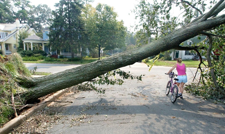
A woman walks her bicycle under a fallen tree along Forest Hill Ave. in Richmond, Va. on Sunday, Sept. 21, 2003. Hundreds of thousands are still without electricity in Virginia since Hurricane Isabel swept through the area on Wednesday night. (Richmond Times-Dispatch, Dean Hoffmeyer)
Construction workers secure a house in the 4300 blk of Hillcrest Rd. damaged by Isabel . September 20 , 2003
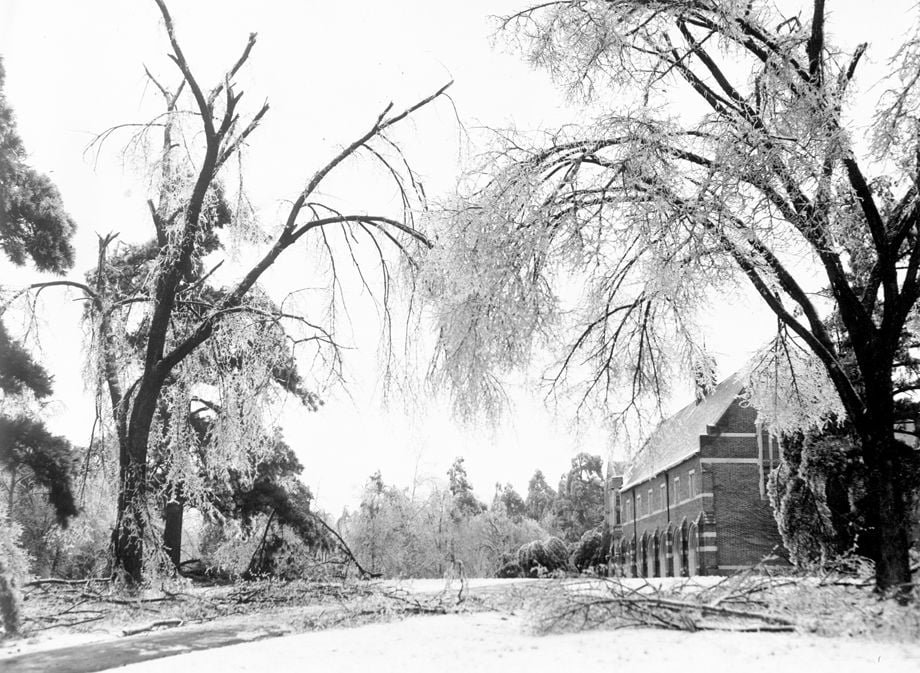
01-20-1943 (cutline): Trees on University of Richmond campus bend with weight of ice.
Lightning strikes downtown Richmond VA during a rain delay of the Richmond Flying Squirrels against Akron RubberDucks game at The Diamond Fri. Aug. 18. 2017. The Diamond lost power briefly during the storm.
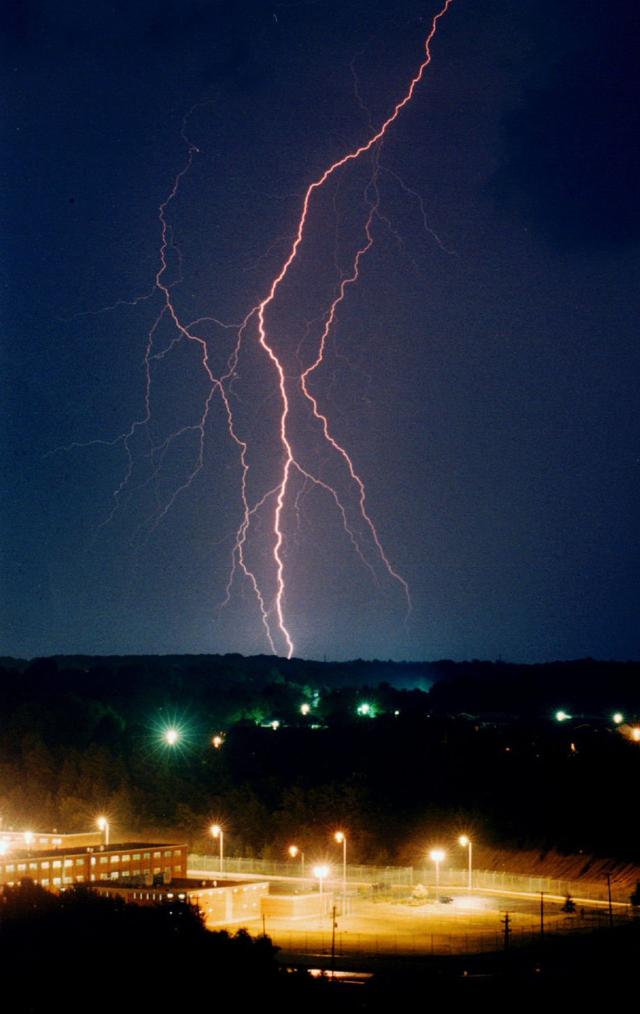
Lightning crackles over the city jail in the northeastern night sky. A severe electrical storm passed over the northern half of Richmond Sunday evening knocking out power to some areas.
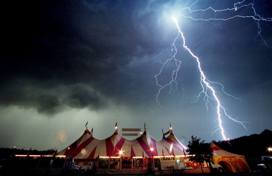
Lightning rips through the clouds over a circus tent in Glen Allen, Va. on Fri., April 23, 1999. The evening performance of the Cole Brothers Circus was cancelled due to a line of severe thunderstorms with high winds, marble-sized hail, and lightning that passed through central Virginia.
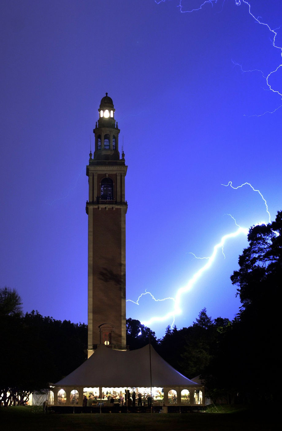
Heart A la Carte party goers were treated to quite a show, including a lightning storm that passed over the Carillon during dinner on 5/13/2000. Heart A la Carte is the heart associations annual fund-raising ball; this year's theme was New York, New York.
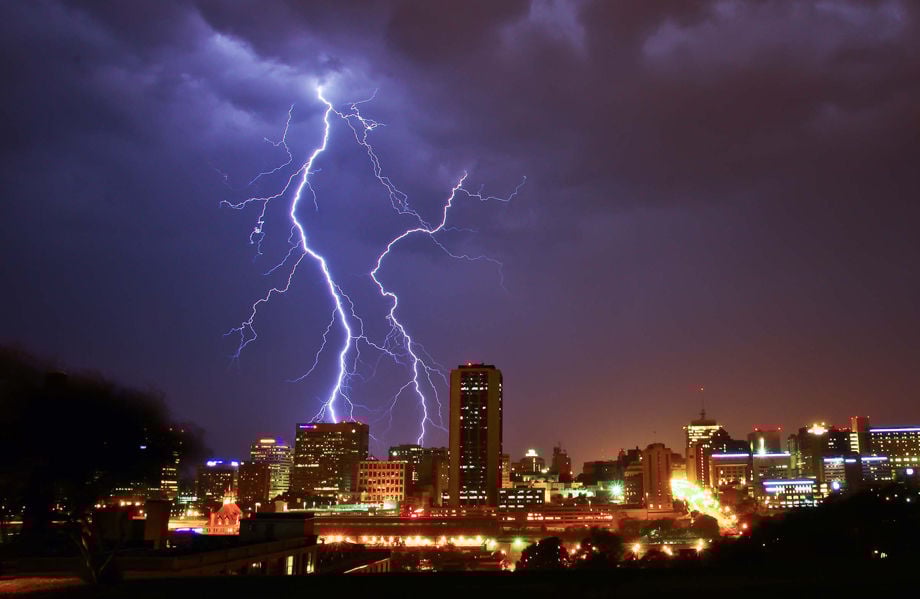
Lightning strike over Richmond, photographed from Church Hill overlook, at 11 P.M. Friday, June 29.
A rainbow formed over the skyline of Richmond after a storm blew through causing tornado warnings, Thursday 5/22/2014.
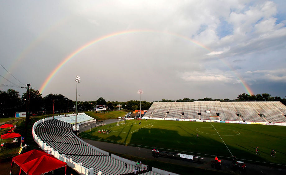
A double rainbow after a storm passed at City Stadium in Richmond VA Sun. July 28, 2013. A stormed delayed soccer between Richmond Kickers and Tampa for about an hour.
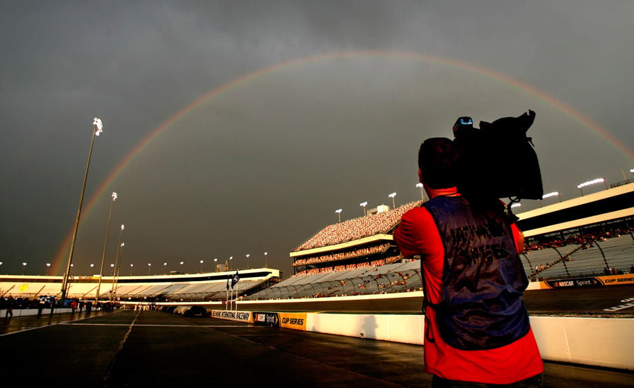
A thunderstorm, with an accompanying rainbow, delayed action in the Blue Ox 100 at Richmond International Raceway on Thurs.
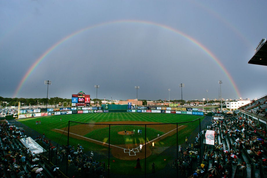
A rainbow arches over The Diamond as fans wait out a short rain delay.
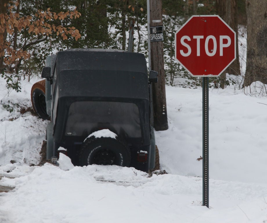
This four-wheel-drive Jeep evidently hit a patch of ice and climbed a bank while trying to get through the intersection of Kukymuth Rd. and Barksdale Rd. in eastern Henrico County, VA Tuesday, Jan. 10, 2017.

Ice coats the banks of the Chickahominy River by the Hanover Road bridge Tuesday, January 2, 2018.
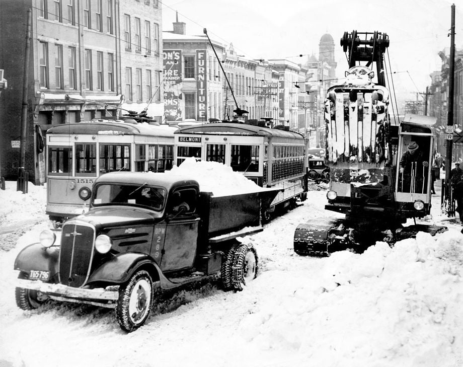
This January 1940 image shows downtown Richmond near 13th and Main streets two days after a storm dumped 15 to 22 inches of snow across the area. Many workers in the area stayed in downtown hotels because it was too dangerous to travel home. Some last-minute guests slept in chairs or on the floor of some lobbies.

1940 photo of Merritt Ruddock, News Leader reporter. DURING 1940 SNOW STORM, HE RODE FROM BON AIR HOME TO DOWNTOWN ON A BORROWED MULE
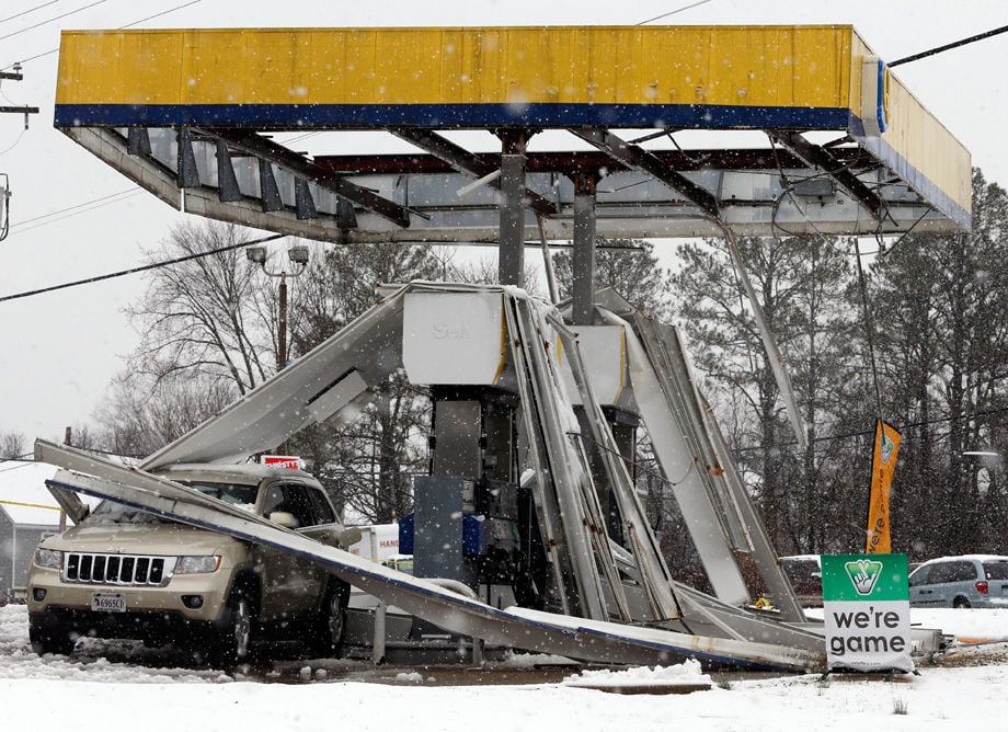
Gusting winds and a heavy wet snow combined to bring the canopy over gas pumps at a station at the intersection of Pemberton and Three Chopt Roads Wednesday.
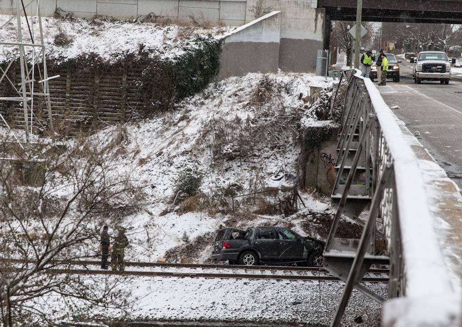
An SUV traveling on Lombardy Street in Richmond hit a patch of ice, slid through a railing and fell off an overpass onto some train tracks below, a Richmond police officer said on the scene.
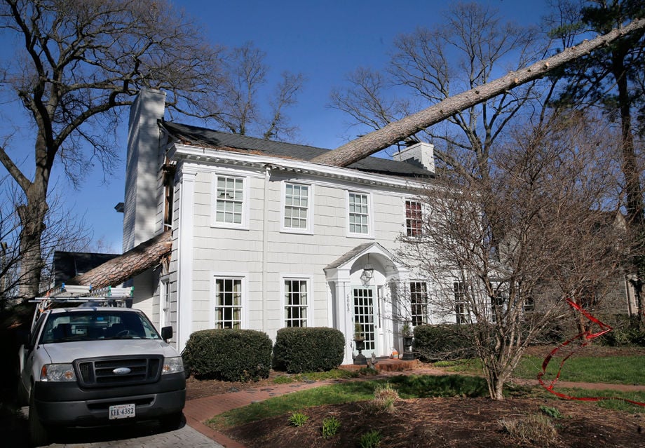
A large tree sliced through this house in the 5300 block of Evelyn Byrd Road in Richmond during a wind gust on just before noon on Friday, March 3, 2018
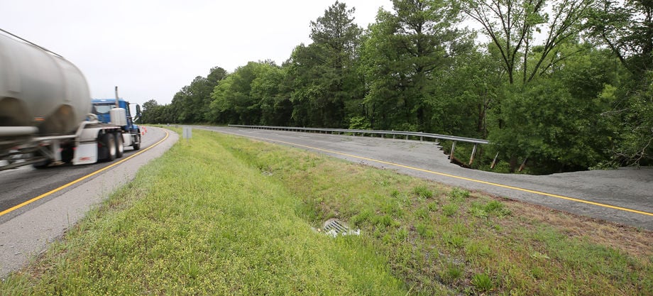
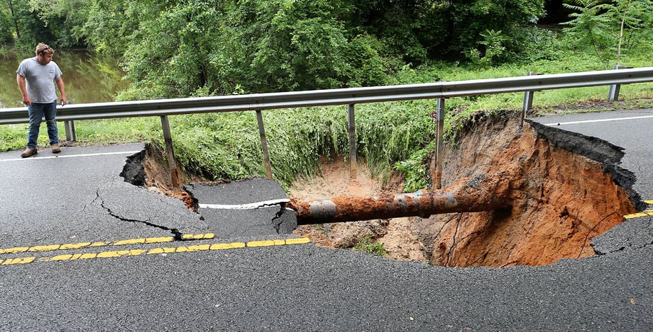
Two lanes of Route 30 west of Meadow Farm were closed after one lane was washed away after heavy rains this week. Traffic was diverted to an eastbound lane of Route 30 Saturday, May 19, 2018.
A large tree awaits removal at Byrd Park near the Round House on Aug. 16, 2010
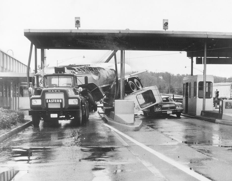
10-03-1971 (cutline): The driver of an empty tanker lost control of the truck in heavy rain yesterday in Petersburg, and it jack knifed and crashed into a toll booth on Interstate 95. The impact knocked the booth onto an automobile stopped at the toll plaza. The attendant in the booth saw the truck coming and ran from the booth before it was toppled. There were no serious injuries.
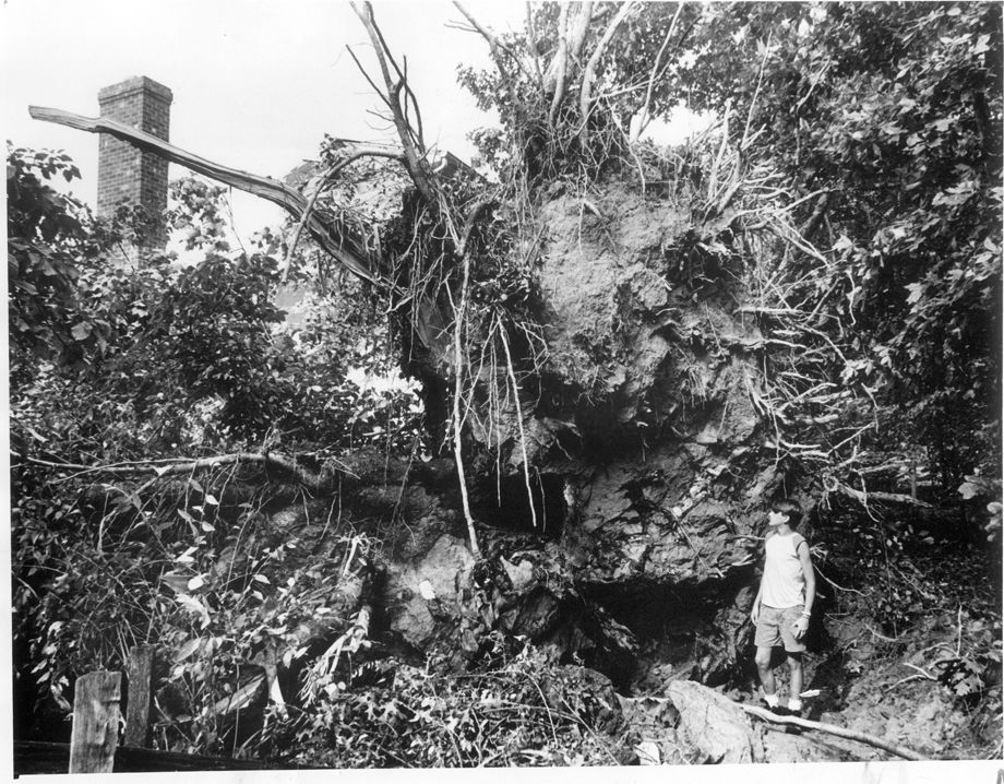
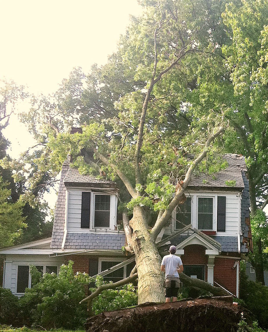
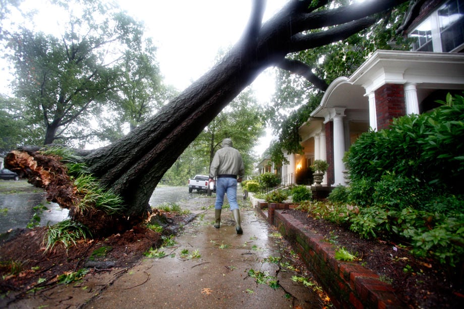
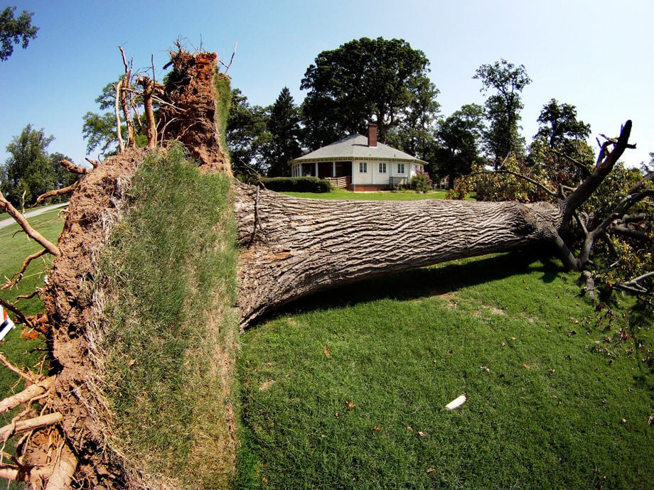
In July 1988, 15-year-old John Moncure – who was 5 feet, 9 inches tall – was dwarfed by the roots of a tree that fell through his neighbor’s house on Lakeside Avenue in Henrico County during a storm. The teen’s father estimated that the tree was 150 feet tall.

Clouds and the setting sun form an evening design in the sky over Midlothian Sun. July 22, 2018.
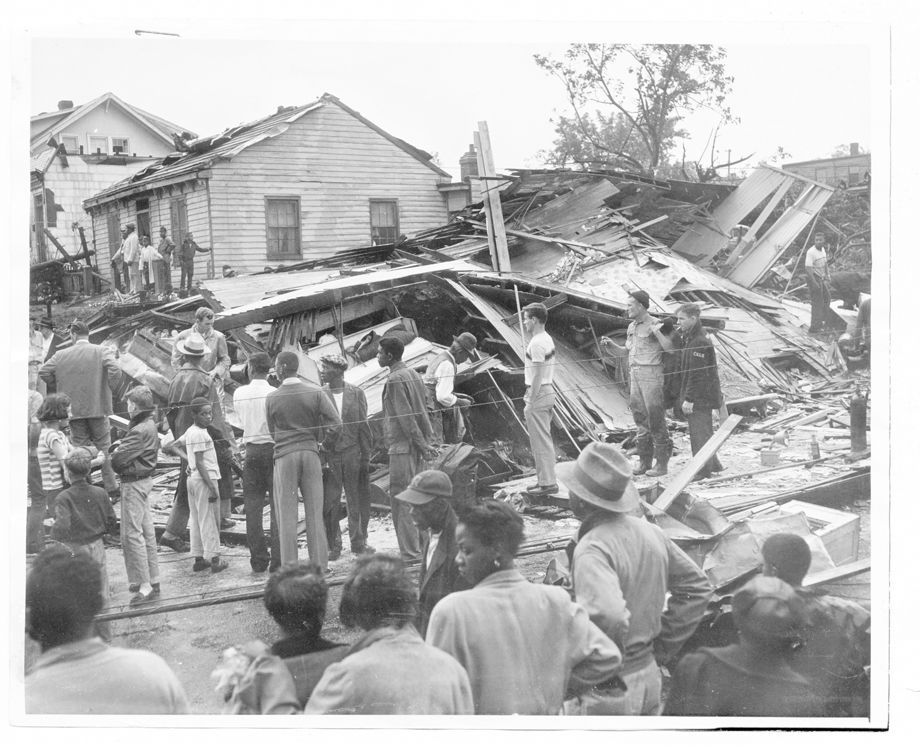
Firemen and neighbors look at rubble of house at Allen and Maplewood avenues in Richmond, destroyed by tornado June 13, 1951. Staff photo.
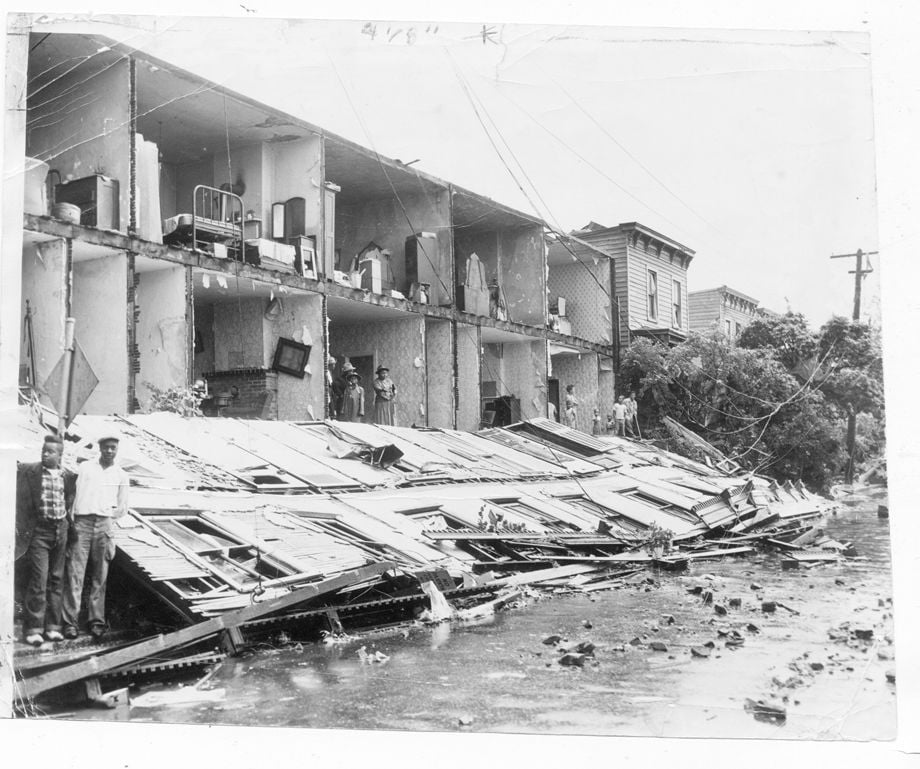
A tornado that followed a 4-mile serpentine route through Richmond in June 1951 peeled away a continuous façade on a row of houses in the 300 block of South Lombardy Street. Although hundreds were injured by the tornado, no deaths occurred. Staff photo.
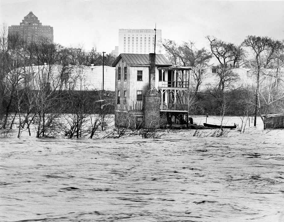
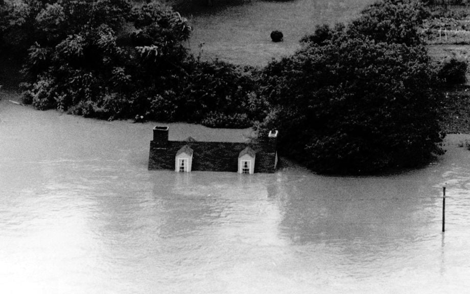
In March 1963, the roiling waters of the James River surrounded a dwelling on Sharp's Island near the 14th Street bridge. While the rain-swollen river didn’t crest as high as originally feared, it did reach more than 4 feet above flood stage at Westham and about 5 feet above flood stage at the City Locks.
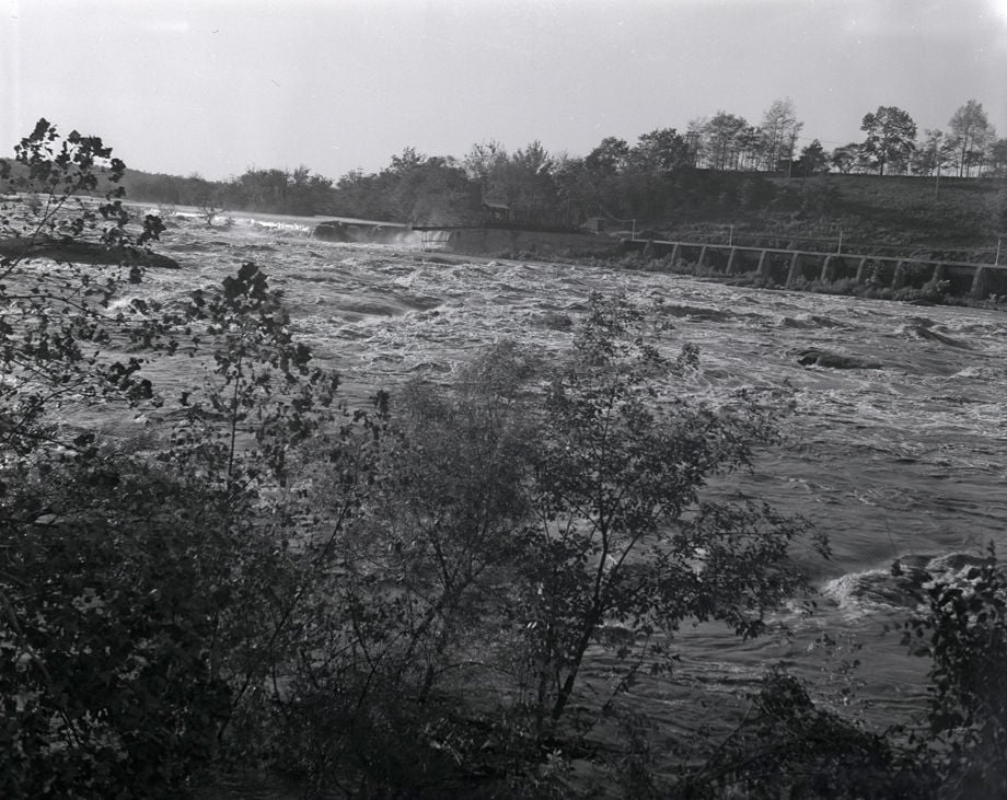
9-1-1955 (cutline): The James, swollen by hurricane rains like all Virginia rivers, begins to flood its banks in Richmond.
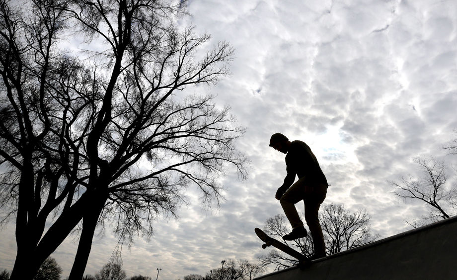
Tamr Andary gets set to skateboard down a ramp at the skateboard park at Carter Jones Park, Dec. 30, 2014. The skateboard surface had dried out from Monday's rain, drawing a handful of skateboarders Tuesday afternoon. The park is on Perry Street, at W. 28th Street.
In late April 1937, after days of heavy rain across the state, the James River crested at 27 feet in Richmond, with flood damage here estimated at more than $100,000. Tate Field on Mayo Island was more like a lake – an example of the recurrent flooding that in part prompted team owner Eddie Mooers to build a new baseball stadium for his Richmond Colts several years later. 4-27-1937: During the 1937 flood, the old ball park on Mayo Island looked like a lake.
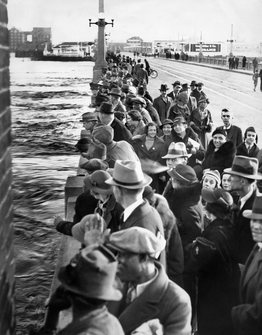
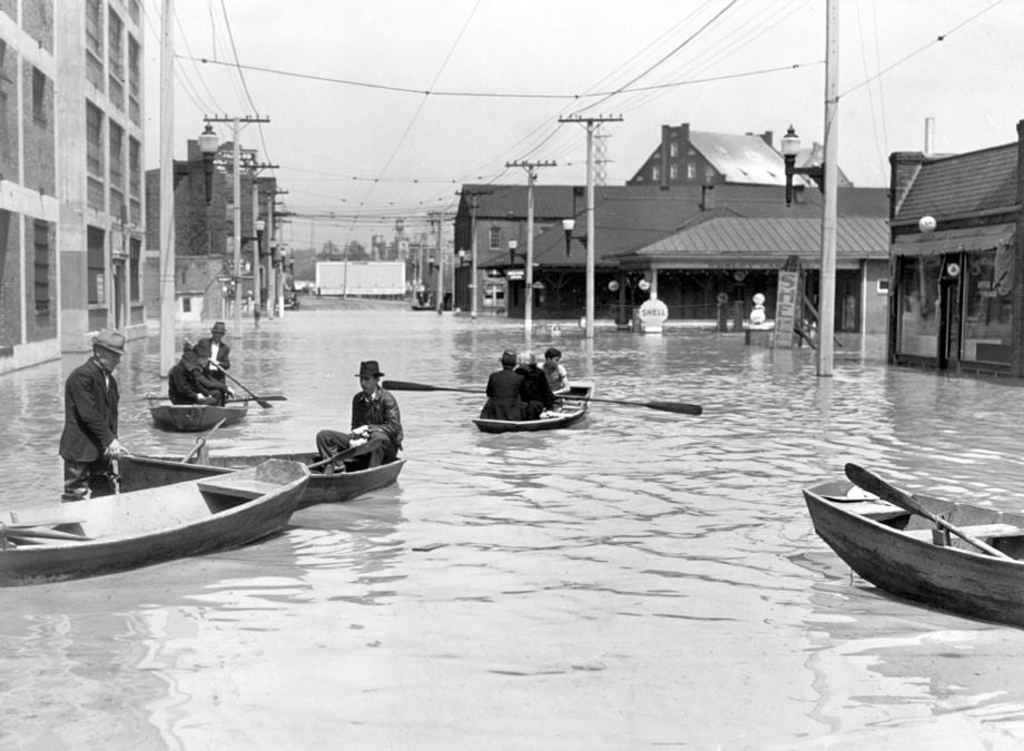
In March 1936, throngs of Richmonders crowded the Mayo Bridge at 14th Street to view the torrent of the James River. Shortly after this photo was taken, the span was closed to traffic and spectators. Flooding in a dozen Eastern states killed more than 100 people and, while the James crested at 28.3 feet, the temporary dike at the foot of 17th Street held.
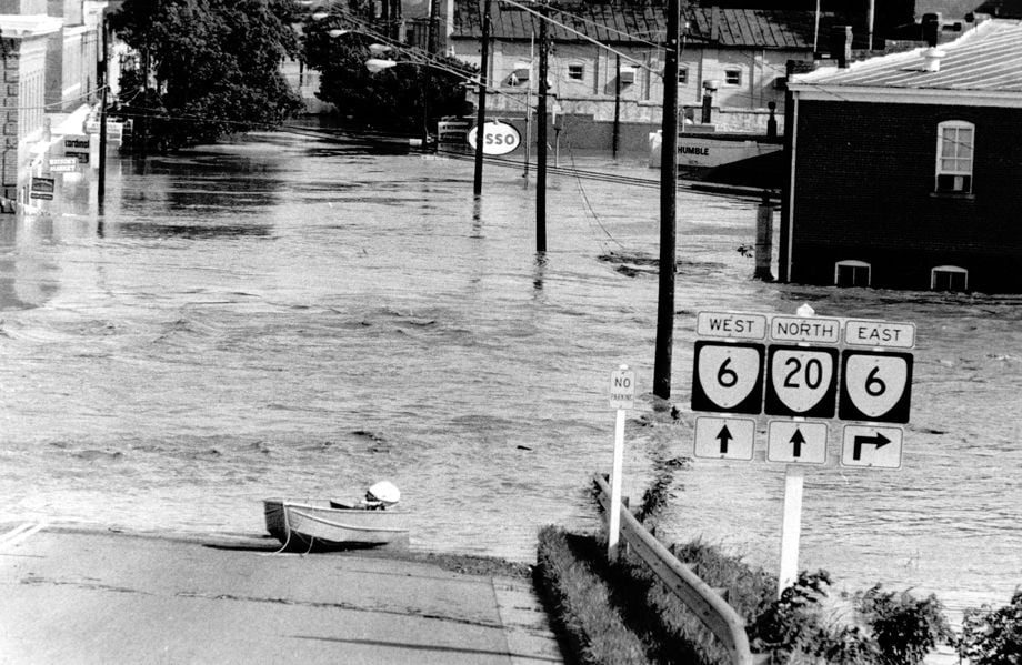
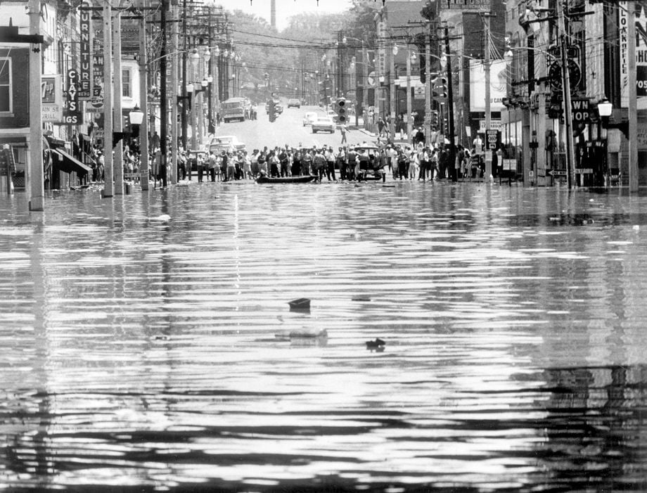
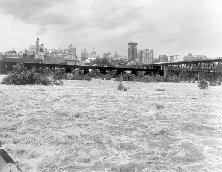
In June 1972, the remnants of Hurricane Agnes brought some of the worst flooding in decades to Richmond, as seen in a watery railroad underpass in the Shockoe area of Richmond. The James River crested at 36.5 feet at the city locks.
In June 1972, residents of a neighborhood in the town of Columbia, in Fluvanna County, stood at the end of a flooded street off state Route 6. The remnants of Hurricane Agnes brought some of the worst flooding in decades to many parts of the state, including Richmond.
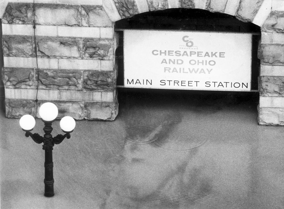
In June 1972, the remnants of Hurricane Agnes brought some of the worst flooding in decades to Richmond, as seen in a watery entrance to Main Street Station downtown. The James River crested at 36.5 feet at the city locks.
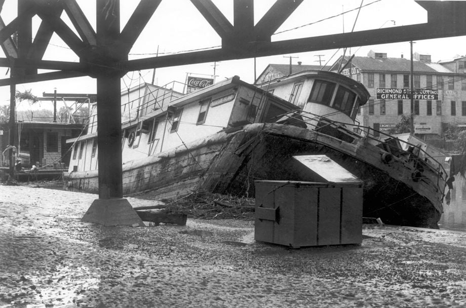
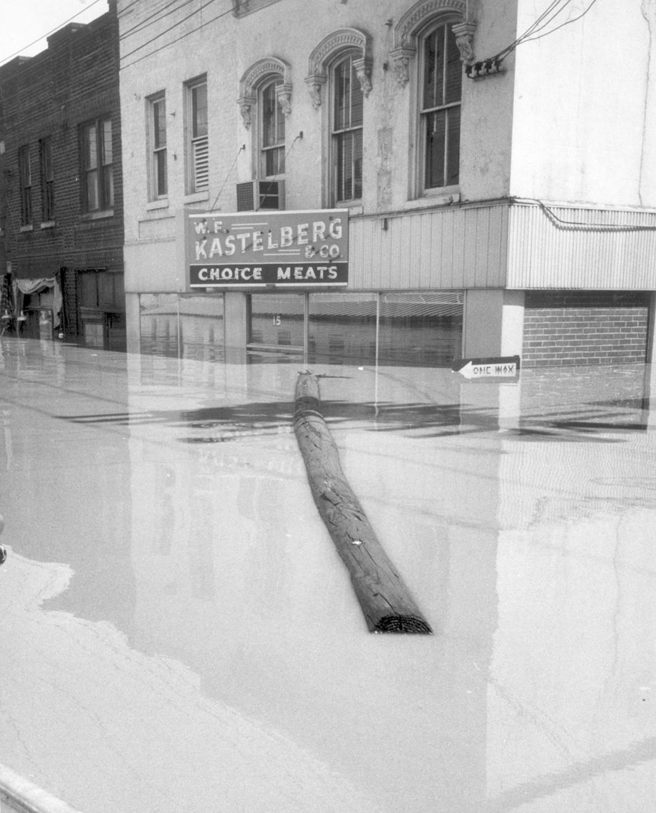
In June 1972, the remnants of Hurricane Agnes brought some of the worst flooding in decades to Richmond. The James River crested at 36.5 feet at the city locks. This image taken along South Dock Street shows the Pleasure Island, a floating restaurant and one-time nightclub, wrecked near its dock. In 1950, the boat made headlines by anchoring in Maryland waters to escape Virginia regulations.
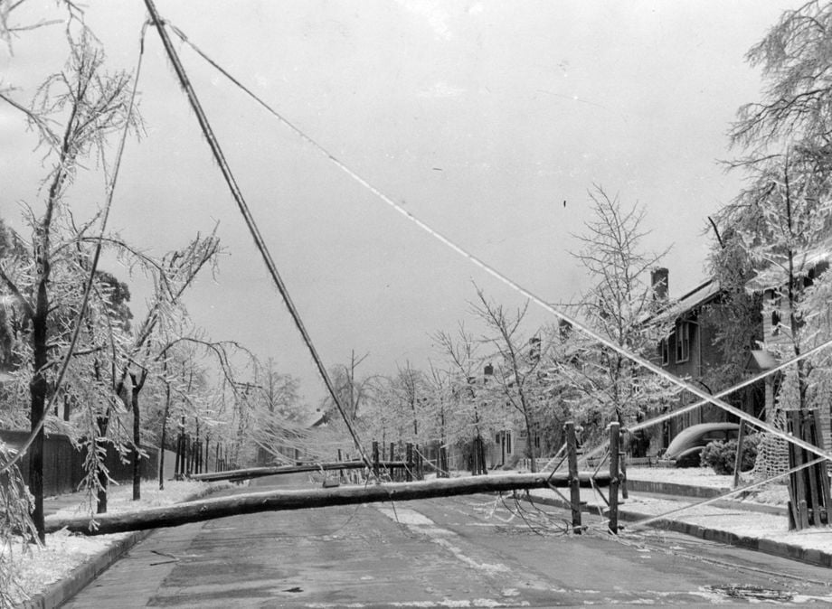
Richmond, January 1943: "Two poles blocking the way, 38th Street is a mass of wires."
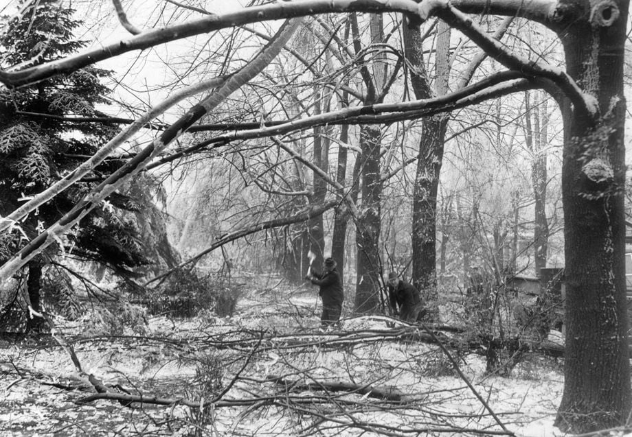
Richmond, Jan. 31, 1943: “One of the hardest hit blocks in the city last week was the 3500 block of Seminary Ave. This picture... shows city workers cutting up the larger limbs to be taken away in trucks.”
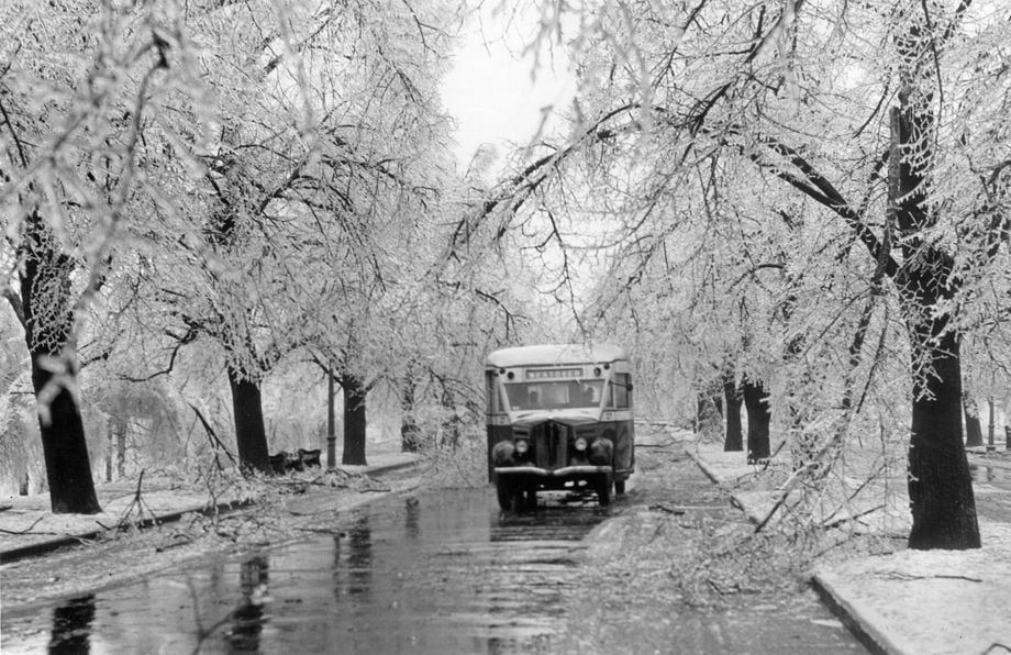
A bus made its way past trees coated with ice in Byrd Park during the “sleet storm” that hit Richmond in January 1943.
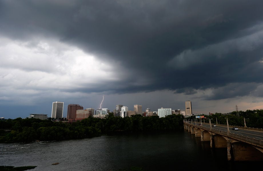
Lightning strikes behind the city of Richmond, Virginia Tuesday July 19, 2016. Strong storms and high winds hit the area that caused power outages and tree damage.
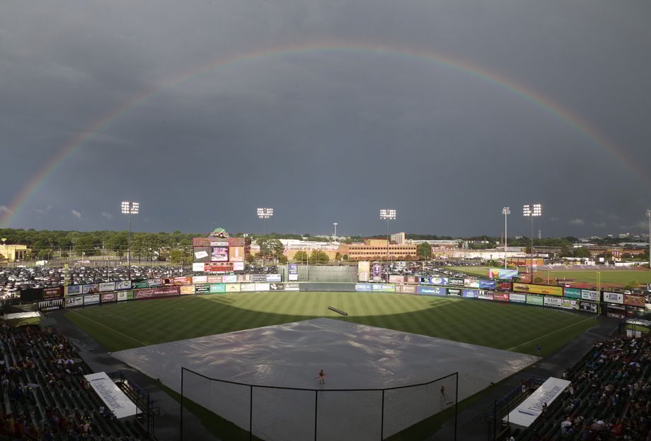
After a storm passed by, rainbow appears at the Diamond before the game of Richmond Flying Squirrels and Akron RubberDucks in Richmond on Saturday, July 4, 2015.
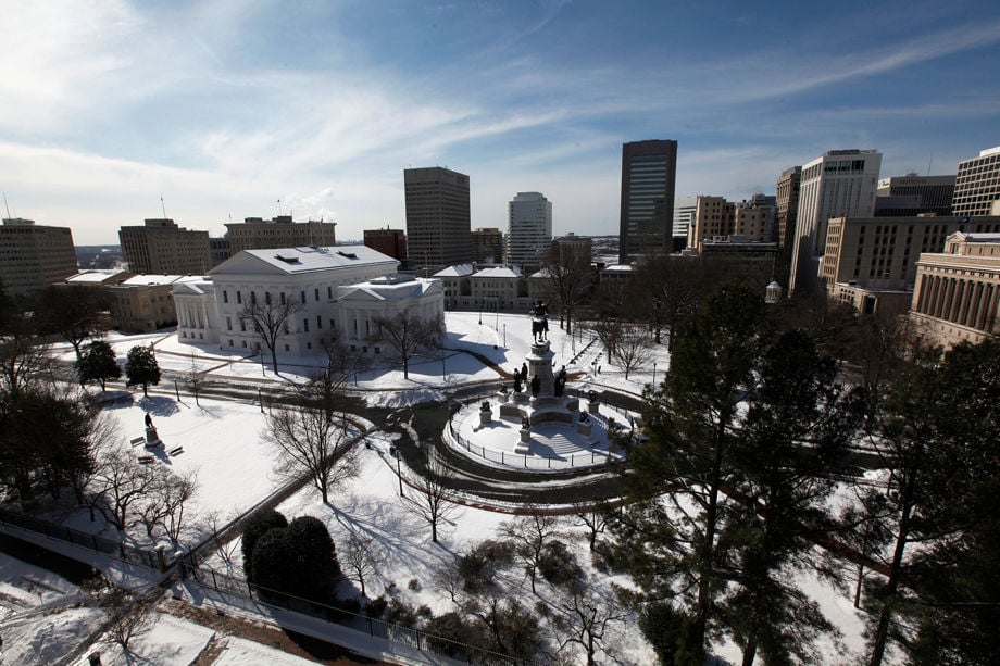
Snow-covered Capitol Square in Richmond, VA Tuesday, Feb. 17, 2015.

Garrett Keshena takes a tumble while sledding at Libby Hill Park on Saturday Jan. 7, 2017.
In March 1953, a late-winter snowfall kept traffic to a crawl along West Franklin Street. Though 4 inches blanketed the city, public schools remained open but were sparsely attended.
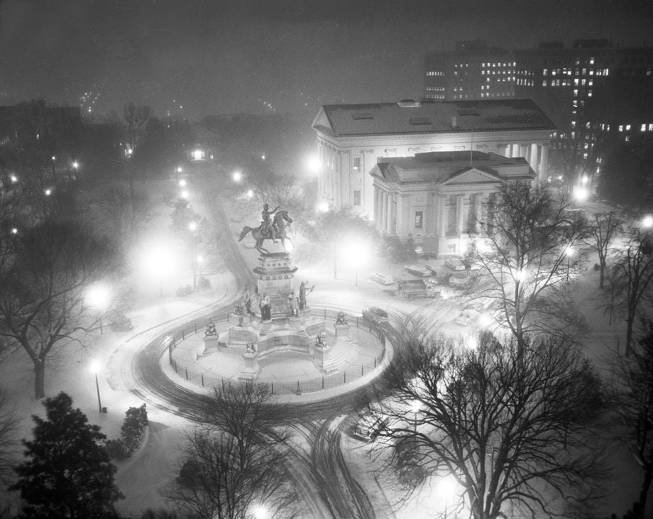
In December 1958, the Richmond area received about 7 inches of snow, creating a memorable nighttime image of the George Washington equestrian statue at Capitol Square downtown.
Richmond Police Officers Albert Sanderson (left) and David Marakovitz take pictures as a vehicle is pulled off of N. Boulevard at Robin Hood Rd. where it flipped when it drove up a utility pole support wire, Feb. 16, 2015. The officers said that the driver, who was uninjured, was going too fast for the snowy surface. A digger from Metheny Contracting was utilized to pull the flipped vehicle off of Boulevard.
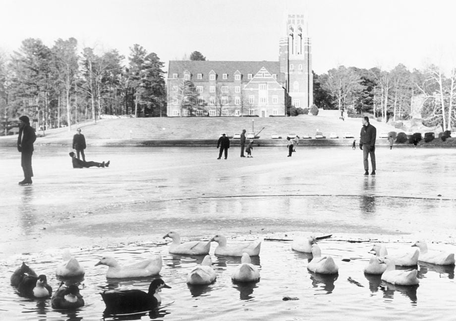
The unlikely combination of ice skaters and ducks appeared at the lake at the University of Richmond yesterday to take advantage of the clear skies and not too uncomfortable temperature of 35 degrees. The picture could change today, however. The local forecast calls for cloudy skies and some light snow or sleet likely by afternoon or evening. The high will be in the middle 30's.
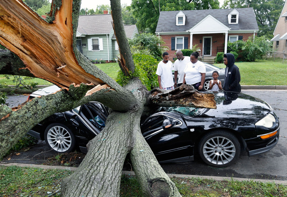
Ameyah Graves (far right) couldn't believe that her mother's car was totaled by a fallen tree during Thursday night's storm. She and neighbors along Patrick Avenue lost their power. From left: Jonas Baptist, George Ingram, Audreyel Mobley, Aquan Mobley (7), and Ameyah Graves. Graves said the car was just repaired the day before. June 17, 2016.
Storm damage in the Bellevue area of Richmond- Holly Lawn on June 17, 2016.
Brian Walton with his storm damaged house at South Drive and Keichtee Drive in south Richmond. Walton was in his house when the tree fell into it.
The setting sun turned the clouds into layers of gold over eastern Henrico County, VA after rain left the area Wednesday, Sept. 21, 2016.
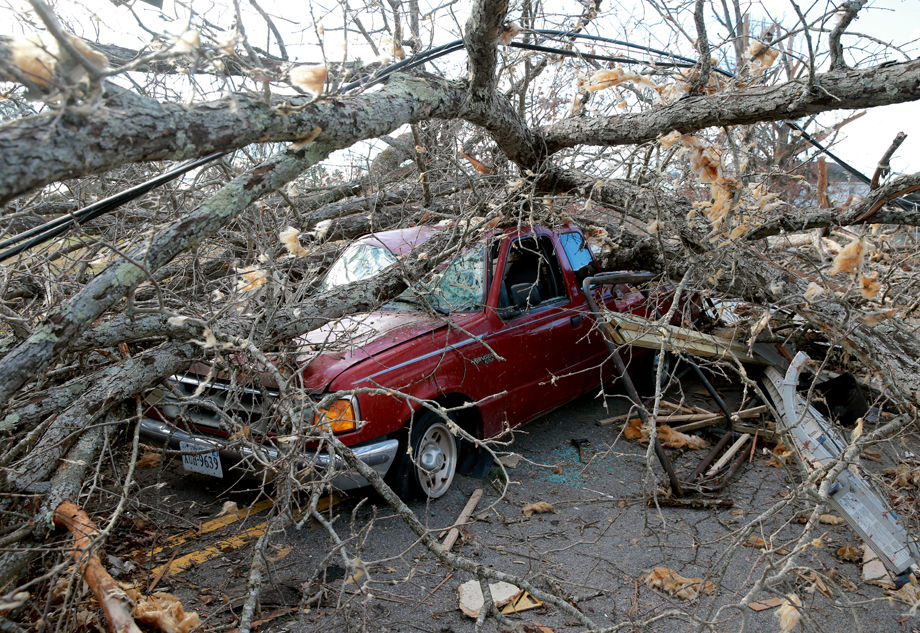
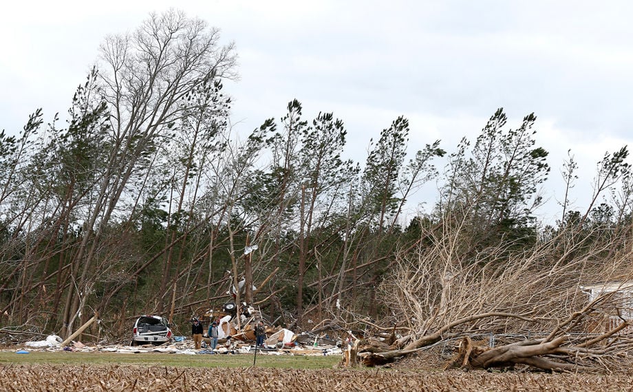
A vehicle is damaged by fallen trees from Wednesday's tornado in Waverly on Thursday.
Damage along Kino Rd. off of Rt. 360 in Tappahannock Va Thurs. Feb. 25, 2016.

Damage along Kino Rd. off of Rt. 360 in Tappahannock Va Thurs. Feb. 25, 2016.
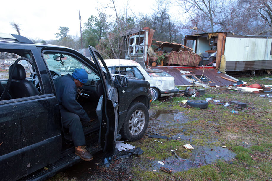
Vincent Donald cleans up a vehicle next to his damaged trailer house as a tornado hit Waverly Wednesday afternoon.

![A1 Minute! August 16, 2024: Chesterfield has much to gain with Fall Line Trail; Kicker’s extend Sawatzky’s contract; Top Five[A1]](https://bloximages.newyork1.vip.townnews.com/richmond.com/content/tncms/assets/v3/editorial/9/d5/9d58940d-25be-55a0-a6bf-2d4848247270/66bf6d5c6cad0.image.jpg)